
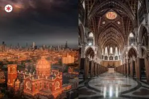
A local’s guide to the postcard views, leafy boulevards, and quiet residential streets that make Chicago beautiful.
Chicago is one of the great looking cities in America.
Most visitors only see five percent of it.
The skyline. Michigan Avenue. The Riverwalk. A view from a tall building. A quick stroll through Millennium Park. Then back to the airport.
The real beauty of Chicago is in its neighborhoods. Seventy-seven distinct communities, each with its own architectural personality, its own tree canopy, its own residential blocks that locals quietly think of as the prettiest in town.
Gilded Age mansions on the South Side that nobody outside Hyde Park has heard of. Boulevards designed in the 1870s as part of an “Emerald Necklace” of green space ringing the city. Streets behind Wrigley Field where each side of the road mirrors the other diagonally. A literal yellow brick road in Humboldt Park.
The streets locals walk on weekends. The boulevards they detour to drive home through. The residential pockets they show out-of-town friends specifically to make them say “wait, this is in Chicago?”
Here are 17 of the most beautiful streets in Chicago, organized by what kind of view you’re looking for. Postcard skylines, leafy boulevards, hidden residential gems, and the streets where Chicago’s culture lives out in the open.
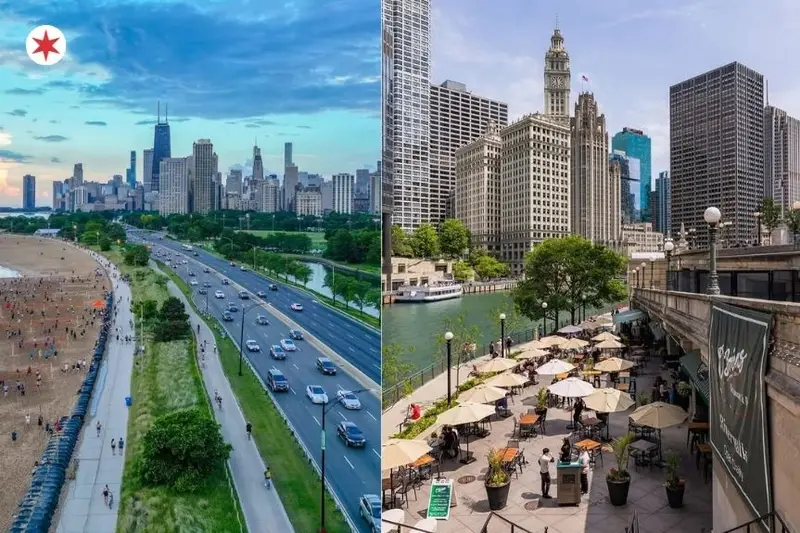
1. DuSable Lake Shore Drive
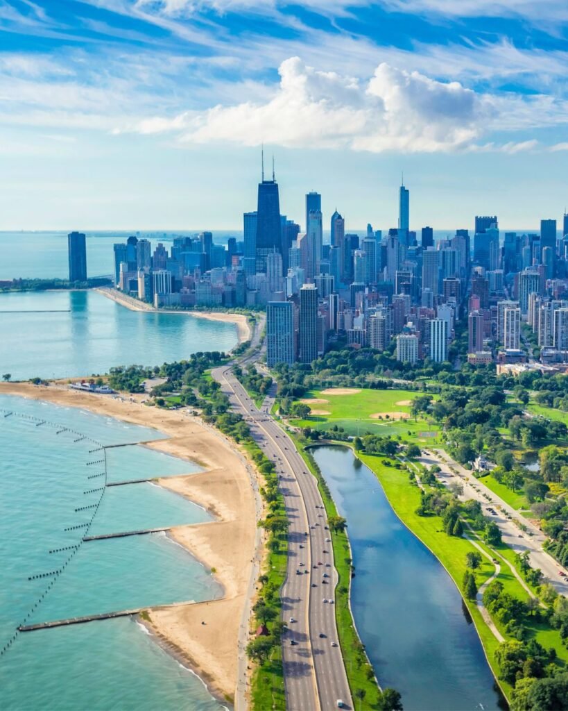
📍 DuSable Lake Shore Drive, running along Lake Michigan from Hollywood Ave (north) to 67th St (south)
This is the most cinematic drive in any American city.
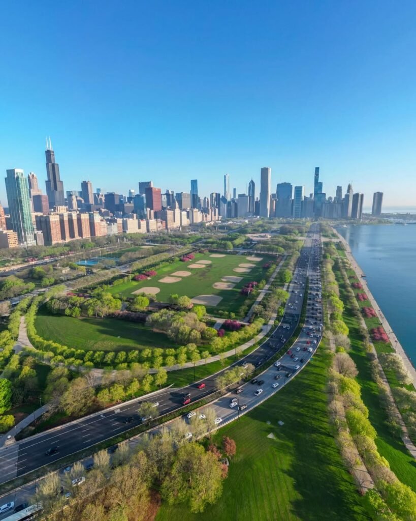
Seventeen miles along the western edge of Lake Michigan, from Hollywood Avenue down to 67th Street. Skyline on one side. Lake on the other. The lake genuinely looks like an ocean from this angle, because at this scale, it kind of is.
The road got renamed in 2021 to honor Jean Baptiste Point DuSable, the Haitian-born trader who founded Chicago. Most locals call it “the Drive.” Some say “DuSable.” Nobody says “Lake Shore Drive” anymore unless they’re being formal.
The northbound view between Roosevelt and Belmont is the postcard. Downtown shrinking in your rearview. The Hancock looming overhead at the Oak Street Beach curve. That stretch is the single most photographed angle of Chicago that exists.
You don’t need a car for any of it. Bus 147 runs the whole length for $2.50. The Lakefront Trail runs parallel for 18.5 miles, mostly flat, mostly car-free. Bike it on a clear July evening and you’ll understand why locals put up with February.
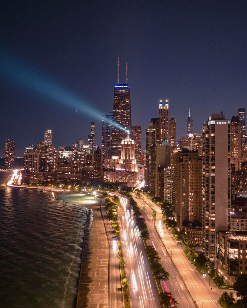
Pro tip: Drive it once at dusk and once at midnight. The contrast is worth the loop. The buildings at midnight look like a different city than the same buildings at 7pm.
Avoid morning rush hour. Avoid after Cubs games. Traffic will kill everything good about it.
The next street on the list is the most famous mile in the Midwest, and locals dismiss it more than it deserves…
2. Michigan Avenue (The Magnificent Mile)
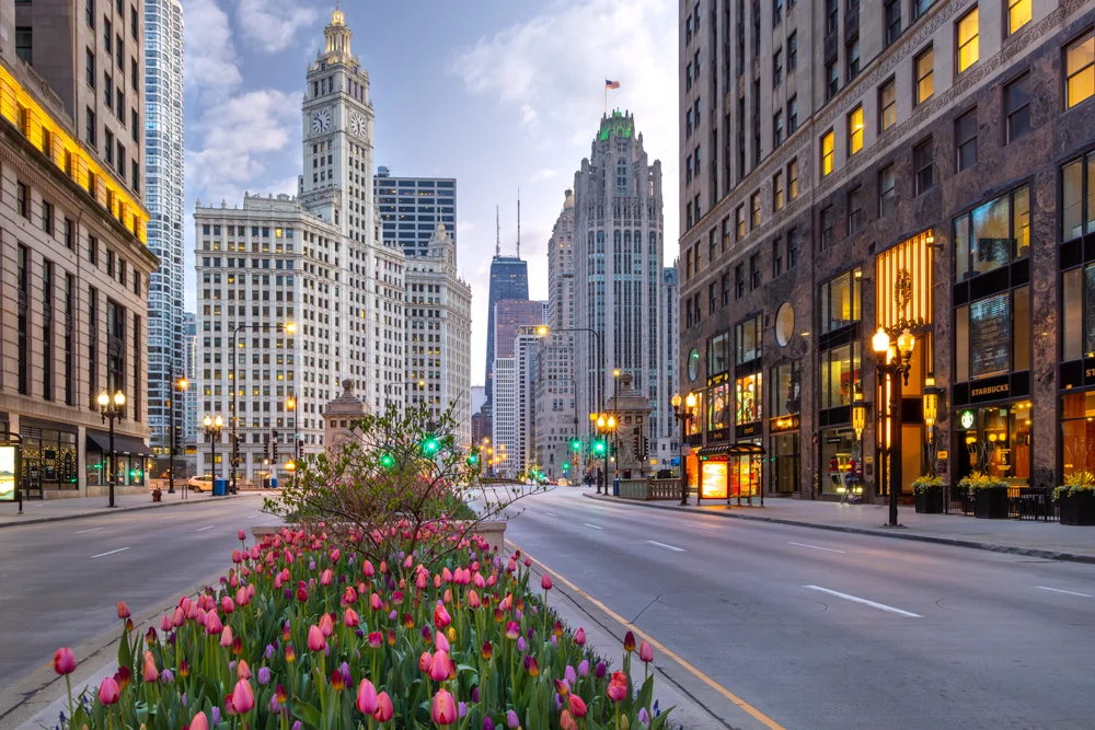
📍 N Michigan Ave, from the Chicago River north to Oak St, Chicago, IL 60611 (Streeterville / Near North Side)
The most famous mile in the Midwest, and locals dismiss it more than it deserves.
Yes, the shopping is the same as every other major American city. Yes, the chains have taken over the storefronts. But the architecture between Oak Street and the river is genuinely extraordinary, and any walk down the full mile produces one of the great urban walking experiences in the country.
The Wrigley Building (1924). Gleaming white terra cotta that glows at night under floodlights.
The Tribune Tower (1925). Neo-Gothic skyscraper with stones embedded in the facade from the Parthenon, the Great Wall of China, and the Alamo. Walk the base and look for the labels.
The Old Chicago Water Tower (1869). One of only seven buildings to survive the Great Fire of 1871.
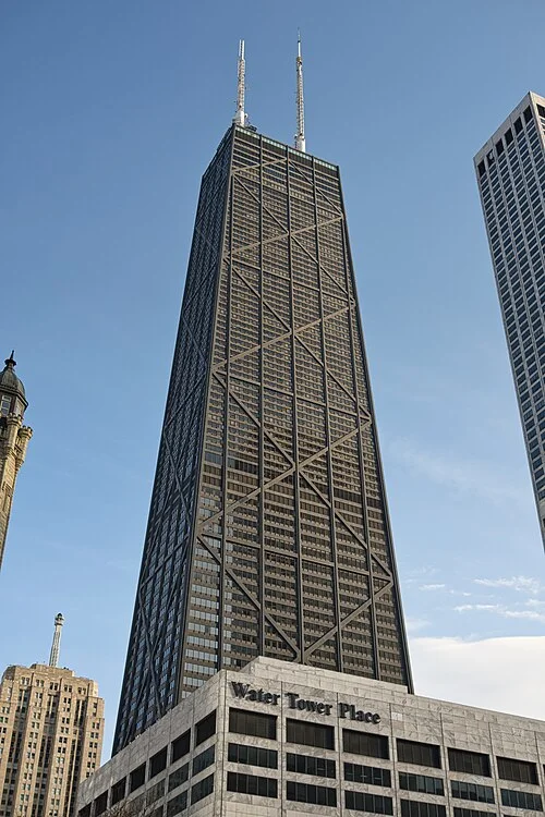
875 N Michigan, formerly the John Hancock Center. Black X-braces that became the structural template for every modern skyscraper.
The single best vantage point on the entire Mile is the Michigan Avenue Bridge, looking south across the river toward the Carbide & Carbon Building. The view is the official starting point of the Mag Mile and one of the most iconic Chicago angles that doesn’t require a tall building to see.
Pro tip: Walk the Mile at night between November and January when it’s lit up for the holidays. The pace is slower. The crowds are festive. The lights stay on through early February. Pair with our Best Lobbies in Chicago guide to step inside the buildings, not just past them.
The next street on the list is the view that turns up in every Chicago architectural photography book…
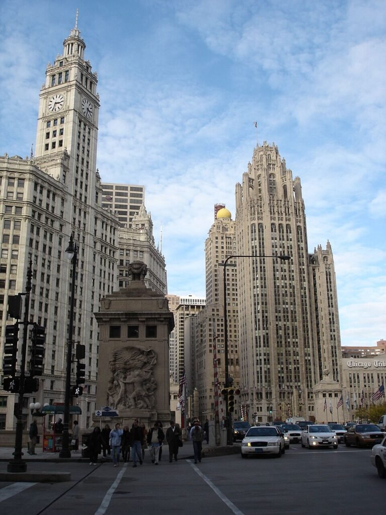
3. The Canyon Of LaSalle Street
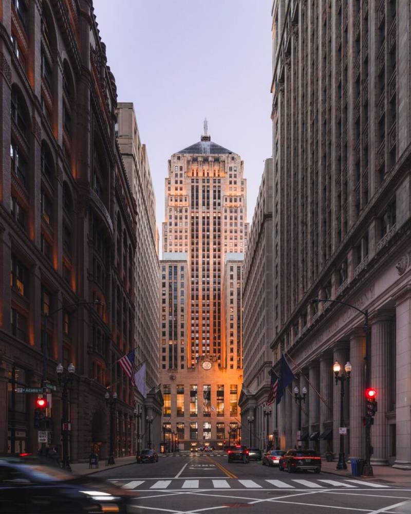
📍 S LaSalle St, looking south from W Madison St to W Jackson Blvd, Chicago, IL 60603 (The Loop)
Stand on LaSalle between Madison and Monroe and look south.
The street narrows. The skyscrapers on either side rise up like canyon walls. At the end of the canyon, sitting at the foot of the street like a temple, is the Chicago Board of Trade Building.
This is the view that turns up in every Chicago architecture photography book, and it earns the placement every time.
The Board of Trade is a 1930 Art Deco tower topped with a 31-foot statue of Ceres, the Roman goddess of grain. Christopher Nolan used it as Wayne Enterprises in Batman Begins. Once you see it in person, you understand exactly why he picked it.
The canyon view is an accident of urban planning. LaSalle Street terminates directly at the Board of Trade, which means anyone walking south is funneled visually toward the most dramatic Art Deco facade in the Loop. The effect is best at golden hour when the western light hits the limestone and the bronze statue.
This is also where most of Chicago’s banking and trading buildings sit. The historic Stock Exchange (now part of the Federal Reserve). The Continental Illinois building. The Rookery, with its Frank Lloyd Wright lobby. All within a two-block radius.
Pro tip: Photograph the canyon from the middle of LaSalle Street at Madison on a Saturday or Sunday morning when traffic is light. Weekday rush hour gives you better motion in the frame but worse photos. The Rookery’s lobby on Adams is open to the public on weekdays during business hours, and walking inside is one of the most underrated free experiences in Chicago.
The next view is the modern Chicago postcard, and there’s a specific bridge where the river, the skyline, and Lake Michigan converge in one frame…
4. Wacker Drive And The Riverwalk
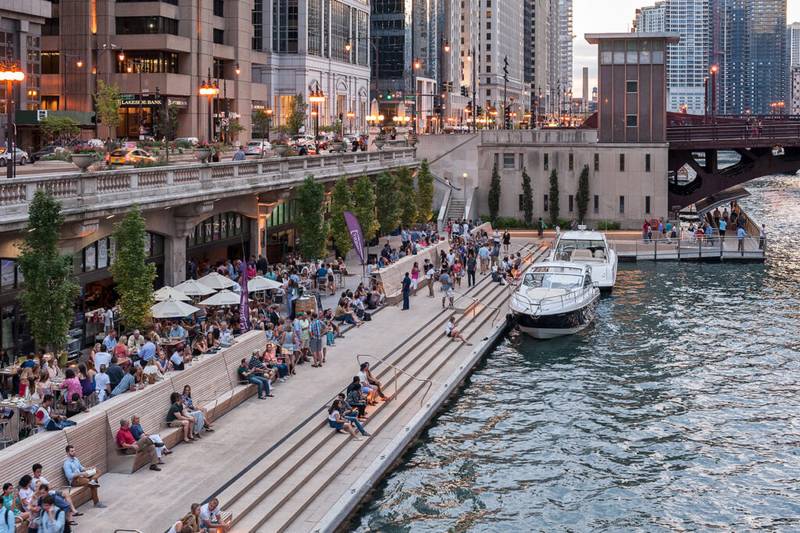
📍 E Wacker Dr along the Chicago River, from Lake Michigan to Lake St, Chicago, IL 60601 (The Loop)
The river views from Upper and Lower Wacker Drive are the modern Chicago postcard.
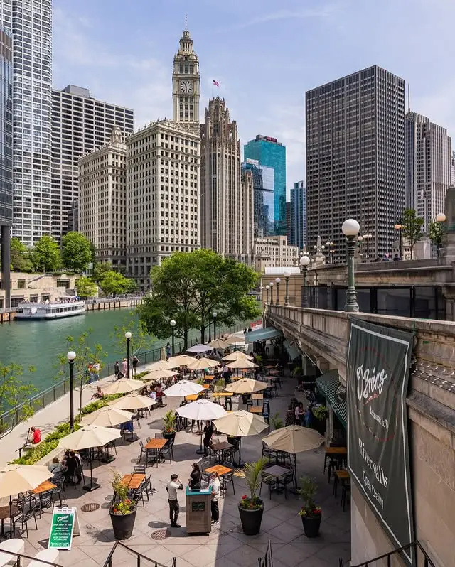
Steel and glass reflected in water. The Wrigley Building anchoring the north bank. Marina City standing across the river like two corn cobs. The Old Post Office and Civic Opera House further west.
The single most dramatic vantage point is the State Street Bridge looking east toward Lake Michigan. The river, the skyline, and the lake all converge in one frame. This is the angle most film and TV productions use when they need to establish “we are in downtown Chicago.”
The Riverwalk runs along the south bank of the river for 1.25 miles. It’s been transformed over the past 15 years into one of the best public spaces in any American downtown. Floating gardens. Stadium-style seating. Restaurants and bars in warm months. Public art everywhere. Free Wi-Fi the whole length.
The whole thing is engineered to make you stop walking and look up at the buildings.
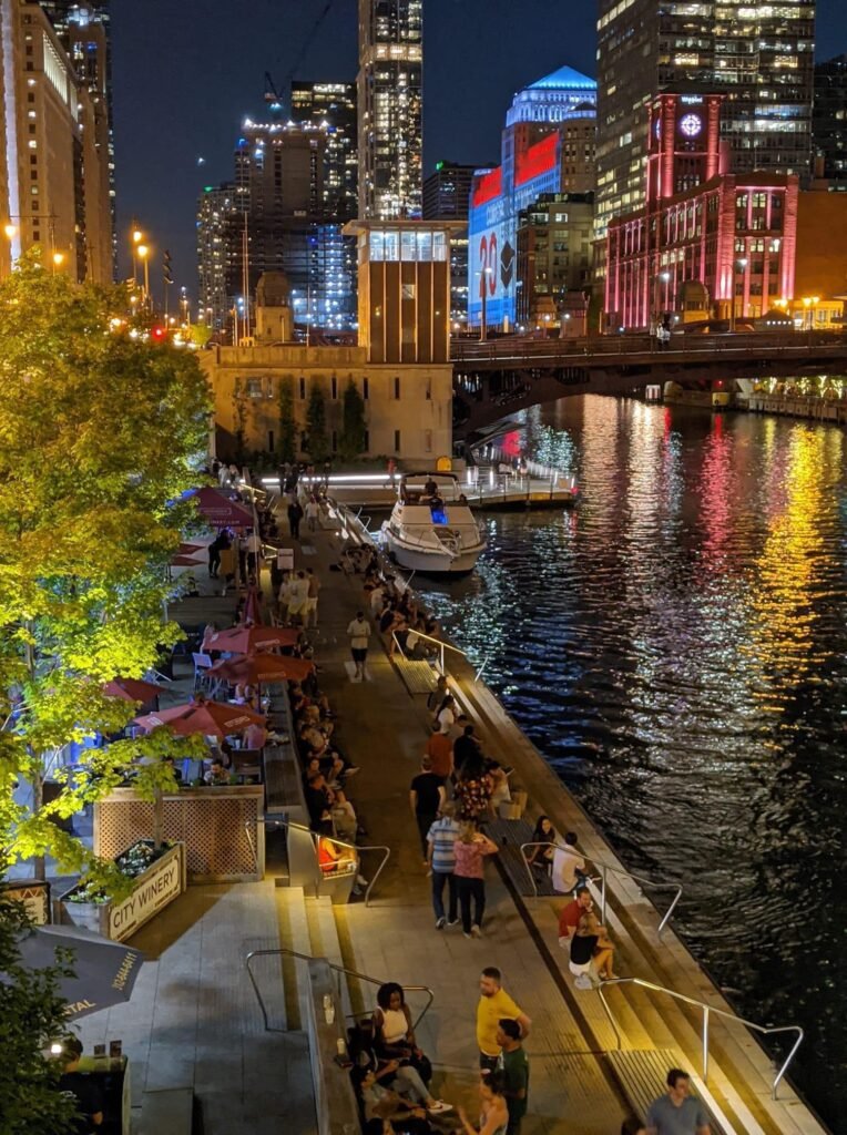
Pro tip: Walk the Riverwalk between 10pm and midnight in summer. The crowds clear out. The buildings are lit. The water reflects everything. If you’d rather see the architecture from the water itself, the architecture river cruise covers the same skyline with live commentary from a docent.
The next category is the boulevard system Chicago designed in the 1870s to ring the city in green space, and four of those stretches still survive today…
Chicago’s Boulevard System
5. Logan And Kedzie Boulevards
📍 N Logan Blvd and N Kedzie Blvd around Logan Square, Chicago, IL 60647 (Logan Square)
The Logan Square Boulevards Historic District is the heart of the Emerald Necklace.
Wide grassy medians divide the boulevards. Mature trees form a continuous canopy overhead. Greystones, brownstones, and Queen Anne mansions from the 1880s and 1890s line both sides, most of them in remarkably good condition for being 130+ years old.
At the center sits the Illinois Centennial Monument (1918), a 70-foot Doric column topped with an eagle. It marks the geographic heart of Logan Square and functions as the neighborhood’s gathering point. People sit on the base. Skateboarders use the surrounding plaza. Sunday afternoons in summer, the steps are full.
Walk the boulevard from the monument east toward Humboldt Park, or south down Kedzie toward Palmer Square. Either direction takes about 30 minutes and gives you a continuous sense of why Logan Square is one of the most desirable Chicago neighborhoods.
Pro tip: Saturday mornings are the best time to walk it. The neighborhood is awake but not crowded. Combine with brunch at Lula Cafe or coffee at Reno on the boulevard’s north side. Logan Square has the best farmers market in Chicago every Sunday from May through October.
The next boulevard runs through the same neighborhood but locals consistently rank it more underrated, and at the southern end is a literal yellow brick road…
6. Humboldt Boulevard
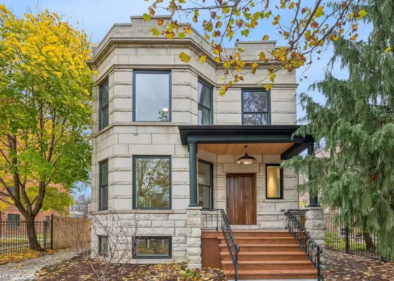
📍 N Humboldt Blvd, between Cortland St and Wabansia Ave, Chicago, IL 60647 (Logan Square / Humboldt Park)
The most underrated boulevard in the Emerald Necklace.
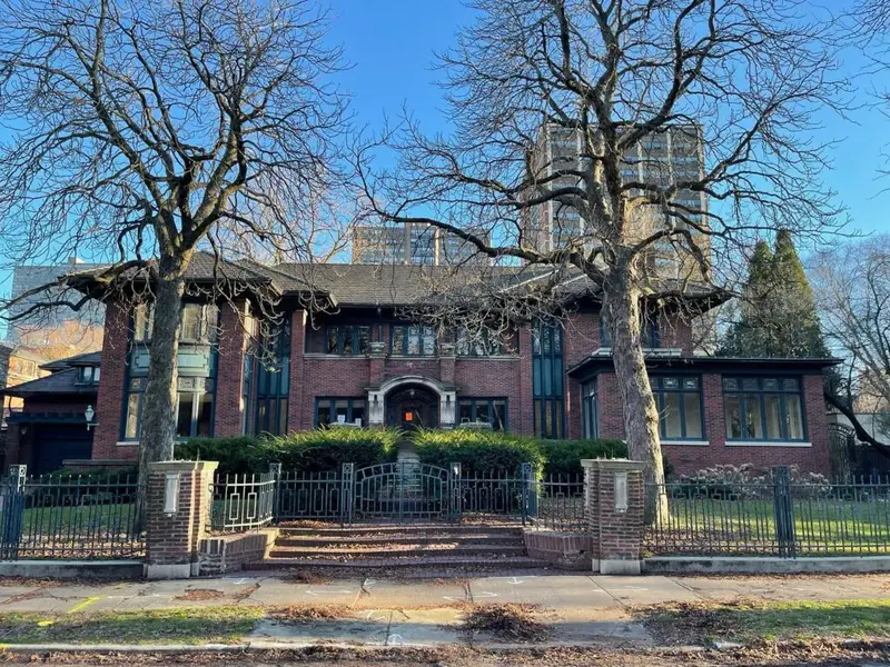
Humboldt Boulevard runs north-south between Cortland and Wabansia. The stretch is lined with massive single-family Gilded Age mansions that almost nobody outside the immediate neighborhood ever sees.
Three and four-story Queen Anne and Romanesque Revival mansions, most built in the 1890s for German and Polish industrialists. Many have been restored over the past 20 years. Some have been broken into multi-unit apartments. Others remain single-family homes.
Walking south from Cortland to Wabansia, you pass mansion after mansion, with the wide boulevard greenery in the middle softening the entire street.
And then at the southern end, at the corner of Humboldt and Wabansia, is the Yellow Brick Road.
L. Frank Baum lived at 1667 N Humboldt Blvd in 1899 when he wrote The Wonderful Wizard of Oz. The original house was demolished decades ago. In 2019, a nonprofit affordable housing developer paved 200 feet of yellow brick sidewalk on the corner to commemorate the spot. A “There’s No Place Like Home” mosaic by Chicago muralist Hector Duarte was added in 2020. Toto is depicted walking the road. A historical plaque tells Baum’s Chicago story.
Pro tip: Walk the boulevard, hit the Yellow Brick Road, and finish at one of the Logan Square coffee shops two blocks east. The mosaic is best photographed in afternoon light when the sun catches the tile work. The block is residential, so be respectful of the people actually living there.
The next boulevard is the South Side answer to the Emerald Necklace, and it runs through one of the most historically significant neighborhoods in Chicago…
7. Drexel Boulevard
📍 S Drexel Blvd, between 39th St and 51st St, Chicago, IL 60615 (Bronzeville / Kenwood)
The Bronzeville version of the Emerald Necklace.
Drexel Boulevard runs through the heart of Bronzeville, the historic Black metropolis of Chicago. Wide boulevard with grassy medians. Ornate Gilded Age mansions on both sides. Historic churches anchoring the corners.
In the late 19th and early 20th centuries, this was one of the most prestigious addresses in Chicago, home to industrial barons before they migrated north. After the Great Migration of the 1910s and 20s, Drexel became the heart of Chicago’s Black professional class.
Louis Armstrong. Bessie Coleman. Ida B. Wells. All lived within blocks of the boulevard at various points.
The mansions are still standing. Many have been restored by Black homeowners reclaiming the boulevard’s historic prestige. The Drexel Square fountain, designed by William Le Baron Jenney (the architect who invented the modern skyscraper), anchors the southern end.
Pro tip: Combine the walk with a visit to the DuSable Black History Museum and the Hyde Park Bookstore, both within a 10-minute drive. The Bronzeville Walk of Fame on King Drive between 25th and 35th has bronze plaques honoring famous residents and is a logical pre or post stop.
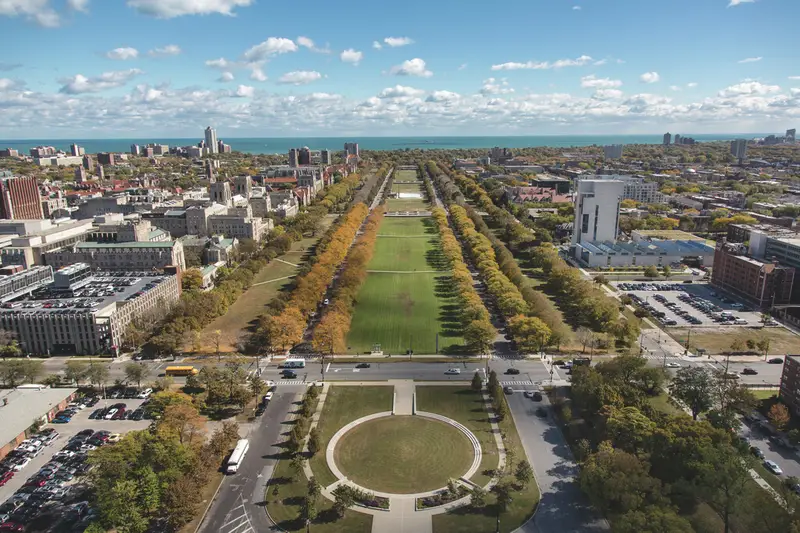
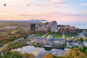
8. Midway Plaisance
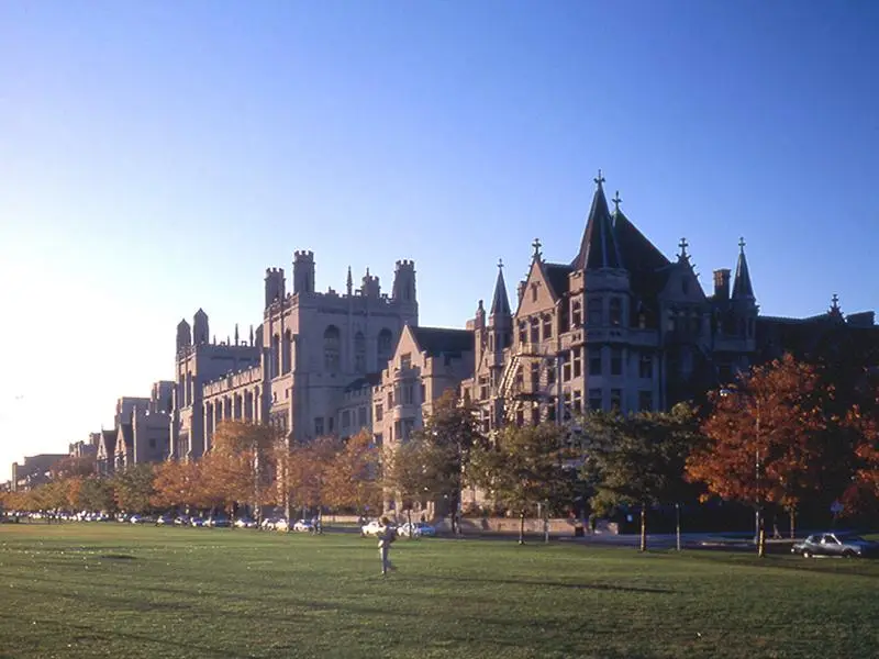
📍 Midway Plaisance, between Washington Park and Jackson Park, running along 60th St, Chicago, IL 60637 (Hyde Park)
A one-mile stretch of grass and walking paths connecting Washington Park and Jackson Park.
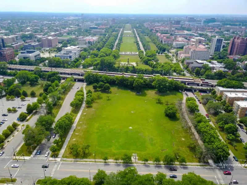
The Midway was designed by Frederick Law Olmsted, the same landscape architect who designed Central Park in New York. It served as the pleasure ground of the 1893 World’s Columbian Exposition, where the world’s first Ferris Wheel stood and where most of the international cultural pavilions of the Fair were located.
Today the Midway is the green centerpiece of the University of Chicago campus.
Collegiate Gothic buildings line both sides. The Quadrangle Club. The Institute for the Study of Ancient Cultures (formerly the Oriental Institute). Rockefeller Memorial Chapel a few blocks south. The combination of wide green space and surrounding Gothic architecture gives the area an Oxford or Cambridge feel that you don’t expect on the South Side of Chicago.
In winter, the Midway turns into a free public ice rink. In summer, the wide lawns fill with students reading, picnicking, and playing frisbee.
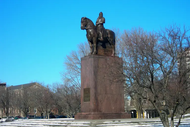
At the eastern end stands the Thomas Masaryk Memorial, a striking bronze statue of the Blaník Knight on horseback, honoring the first president of Czechoslovakia. At the western end is Lorado Taft’s Fountain of Time, a 110-foot sculpture depicting 100 figures marching past the silent hooded figure of Time himself.
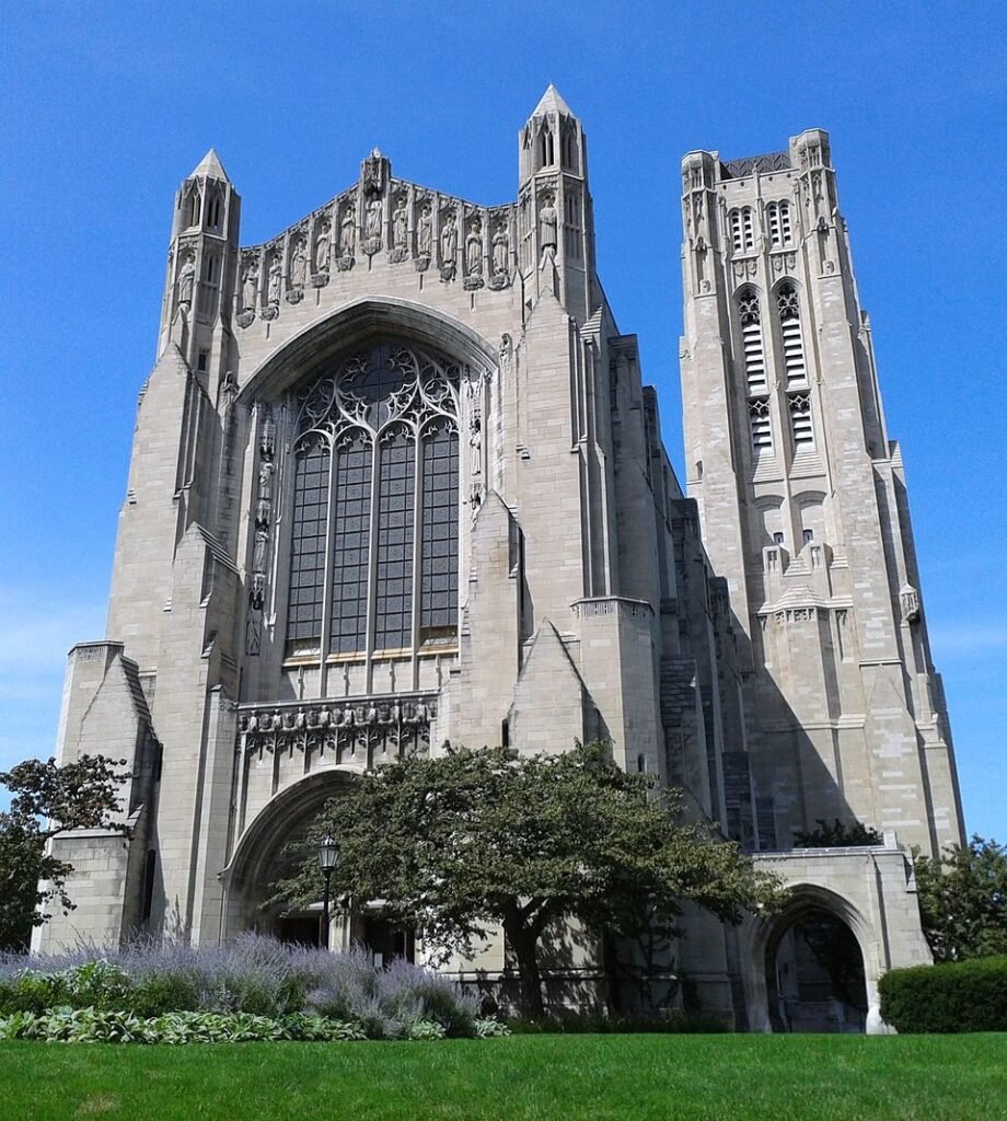
Pro tip: Pair the Midway walk with our Beautiful Churches of Chicago guide to stop at Rockefeller Memorial Chapel, which is one of the most stunning interiors in the city and a 5-minute walk from the eastern end. The Robie House, Frank Lloyd Wright’s masterpiece, is also a 10-minute walk away.
The next category is the streets locals actually know about and visitors don’t, starting with a block behind Wrigley Field that is genuinely unlike anywhere else in America…
Hidden Residential Gems
These are the streets locals know about and visitors don’t. Quiet residential blocks with extraordinary architecture, hiding in plain sight in neighborhoods most tourists never reach.
9. Alta Vista Terrace
📍 N Alta Vista Terrace, between Byron St and Grace St, Chicago, IL 60613 (Lakeview)
The Street of Forty Doors.
This single block behind Wrigley Field is Chicago’s first designated historic district, given the distinction in 1971, and it remains one of the most unusual residential streets in any American city.
Forty Roman-style brick row houses. Twenty on each side. Each house has a matching counterpart on the opposite side of the street, with the layout mirroring diagonally rather than directly across.
Developer Samuel Eberly Gross built the block in 1900 to 1904, modeling it on Mayfair Terrace in London. He intended it as a deliberate Old World import to Chicago, and it works.
Walking down one side of the street and turning around at the end produces the genuine experience of looking at where you just came from. Wrought iron fences. Bay windows. Slight color variations between facing houses that were never meant to be there.
The street is two blocks east of the Addison Red Line stop. Cubs fans walking from the L to Wrigley pass within sight of it without realizing what’s there.
Pro tip: Visit before or after a Cubs game when the surrounding neighborhood has natural foot traffic. Best photographed in late afternoon when the east-facing houses catch the western light. The block takes 15 minutes to walk both sides. There’s no signage marking the historic district.
The next street is the most prestigious residential block in the city, and locals will tell you the only correct time to walk it is in the rain…
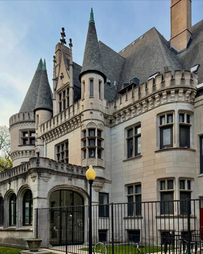
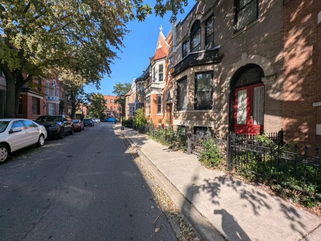
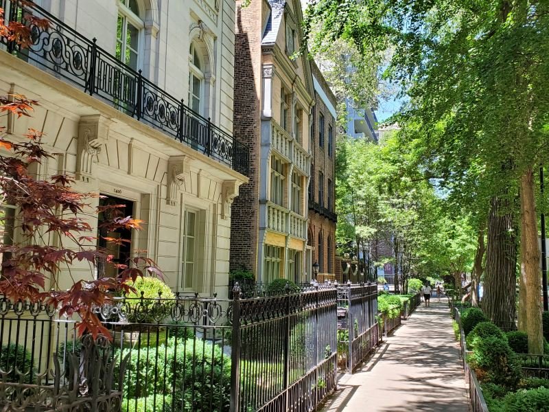
10. Astor Street
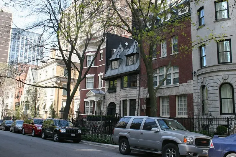
📍 N Astor St, between W North Ave and W Division St, Chicago, IL 60610 (Gold Coast)
The most prestigious residential street in Chicago.
Astor Street runs through the heart of the Gold Coast historic district. Mansions, brownstones, and townhouses from the late 1800s, most of them still in private hands, line both sides for several blocks.
The street’s most famous building is the Archbishop’s Residence at 1555 N State Parkway, technically one block west of Astor but visible from the street. A 19-bedroom mansion that has housed every Cardinal Archbishop of Chicago since 1885.
Other notable buildings include the Charnley-Persky House at 1365 N Astor, an 1891 Adler and Sullivan design that Frank Lloyd Wright worked on as a young draftsman. It’s now a National Historic Landmark.
Locals will tell you the only correct way to walk Astor Street is in the rain.
The wet brick. The reflection of the gas lamps. The way the rain makes the historic facades feel cinematic. It’s a 30-minute walk that feels like a movie. Most of the street has minimal traffic, so even in poor weather you can walk slowly and look up.
Pro tip: Walk it in October or April for the moodiest light. The gas lamps come on around dusk, and the combination with rain produces the exact atmosphere locals have in mind when they recommend it. Bring a real umbrella, not a flimsy one. Chicago wind will destroy a $5 umbrella in five blocks.
The next street holds one of the finest collections of Prairie School architecture anywhere in Chicago, and it’s hidden inside a neighborhood almost no visitor ever reaches…
11. Hutchinson Street
📍 W Hutchinson St, between N Marine Dr and N Hazel St, Chicago, IL 60613 (Buena Park)
The hidden Prairie School street.
Hutchinson Street in Buena Park (a tiny pocket within Uptown) holds one of the finest collections of Prairie School architecture anywhere in Chicago, and almost nobody outside the immediate area has heard of it.
The street was designated a Chicago historic district in 1977. Most of the homes were built between 1890 and 1920 by architect George W. Maher, a contemporary of Frank Lloyd Wright.
Maher designed at least five of the mansions on the block in his signature Prairie style. Strong horizontal lines. Wide overhanging eaves. Expansive porches. Stylized floral ornamentation.
Standout examples: the Claude Seymour House at 817 W Hutchinson and the John C. Scales House at 840 W Hutchinson, both designed by Maher in the early 1900s. Maher’s last design on the street, completed in 1913 for jeweler Claude Seymour, is a 12,000-square-foot, fifteen-room residence that occupies the equivalent of five city lots.
What makes Hutchinson Street unique is the contrast with surrounding Uptown. The block sits two blocks from Lake Michigan and two blocks from the Lawrence Avenue commercial corridor, but it feels like a completely different city. Tree canopy. Wide front lawns. Stately homes. Quiet.
Pro tip: The Buena Park Neighbors organization runs free walking tours of the historic district, with knowledgeable docents who can point out specific Maher details. Check their website for tour dates. The Sheridan Red Line stop is the closest L station.
The next residential gem isn’t one street but an entire small triangular neighborhood that locals call Chicago’s hidden Craftsman bungalow district…
12. The Villa District
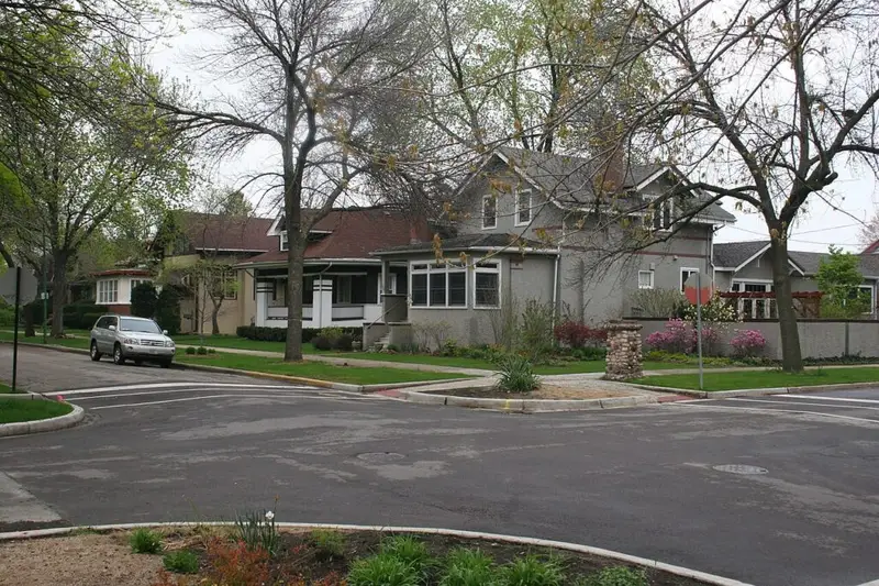
📍 The Villa, between W Addison St and W Belmont Ave, around N Pulaski Rd, Chicago, IL 60641 (Avondale)
Chicago’s hidden Craftsman bungalow neighborhood.
The Villa is a small triangular district in Avondale, developed between 1907 and 1922 as a planned residential community of bungalows, foursquares, and Craftsman cottages. The result is one of the most intact stretches of early 20th-century American Craftsman architecture in any major American city.
The whole district feels different from the rest of Chicago because it was deliberately designed against the grid.
Curving streets instead of straight ones. Wide parkways. Small triangular plots that create unexpected corners.
The houses are smaller than the mansions on Hutchinson or Astor, but they’re more architecturally consistent. Hand-cut stone. Wooden eaves. Leaded glass windows. Front porches of the kind that disappeared from American architecture by the 1940s.
The Villa was added to the National Register of Historic Places in 1983 and is a Chicago Landmark District. Most of the homes are still in original condition, with only modest renovations, which makes walking the area feel like stepping into 1915.
Pro tip: The Villa is small, about three blocks by three blocks. Allow 30 to 45 minutes to walk the whole thing. The entrance arches at Pulaski and Addison are the official gateway and the easiest place to start. Combine with a stop at one of the Avondale taquerias on Addison or Belmont for lunch.
The next residential street is the one locals quietly asked us not to publicize, because the neighbors are tired of it being on lists…
13. Greenview Avenue
📍 N Greenview Ave, between W Addison St and W Irving Park Rd, Chicago, IL 60613 (Lakeview)
The most underrated residential street on the North Side.
Greenview Avenue between Addison and Irving Park is a five-block stretch of Victorian and Queen Anne mansions that almost nobody outside the immediate neighborhood ever walks. Mature trees arch over the street and form a tunnel canopy in summer. The houses are large enough that they read as estates rather than houses, with deep front gardens and wraparound porches.
Locals consistently mention Greenview as one of the most beautiful blocks in Chicago. Many of them specifically asked us not to publicize it.
We’re publishing it anyway, but with the request that you walk it respectfully. These are people’s homes, not exhibits.
The street is best walked in fall when the canopy turns gold and red. Spring also works, when the front gardens come back to life. Combine with a walk through Graceland Cemetery one block east for a full afternoon of architectural appreciation.
Pro tip: The Sheridan or Addison Red Line stops are the closest L stations. Mid-morning weekends are when the street is quietest. Avoid Cubs game days, which turn the surrounding streets into a parking lot for the entire neighborhood.
The next category is the streets where Chicago’s culture lives out in the open. Less about residential architecture, more about the shops, murals, restaurants, and people that make a neighborhood worth walking through…
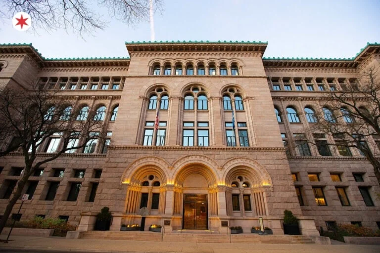
10 Hidden Architectural Details Chicago Locals Walk Past Every Day (But Tourists Never Notice)
Streets With Character
These are the streets where Chicago’s culture lives out in the open. Less about residential architecture, more about the shops, murals, restaurants, and people that make a neighborhood worth walking through.
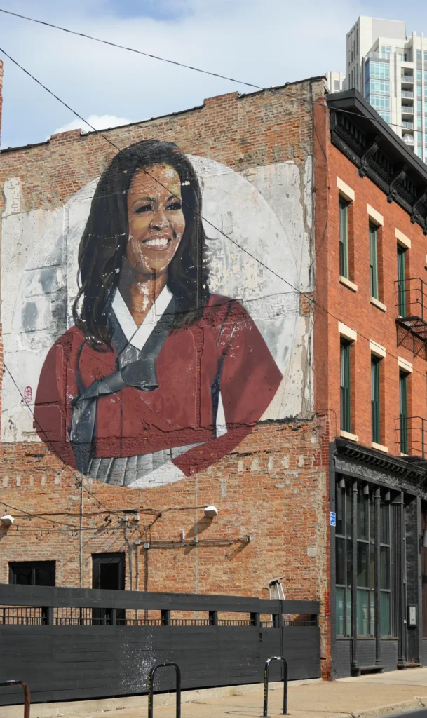
14. 18th Street In Pilsen
📍 W 18th St, between S Ashland Ave and S Halsted St, Chicago, IL 60608 (Pilsen)
The most colorful street in Chicago.
18th Street is the commercial heart of Pilsen, the historically Mexican-American neighborhood on the Lower West Side. Walking it is a sensory experience that has no real equivalent anywhere else in the city.
The buildings are painted in vivid colors. Yellow. Magenta. Cobalt blue. Most have murals on at least one exterior wall, and many have mosaic tile work integrated into the facades. The cumulative effect is that the entire street feels like an outdoor gallery dedicated to Mexican-American culture.
The food on 18th Street is among the best in Chicago.
Carnitas Uruapan at 1725 W 18th St serves what many locals consider the best carnitas in the city. The original location is right on the strip.
Cafe Jumping Bean at 1439 W 18th St is the long-standing neighborhood anchor coffee shop. The kind of place locals have been stopping into for decades.
La Vaca Margarita Bar serves frozen margaritas in pint glasses.
The National Museum of Mexican Art is two blocks south on 19th Street and is free.
Pro tip: Combine 18th Street with the 16th Street murals running parallel one block south. The 16th Street viaducts have the largest concentration of street art in the neighborhood, and the contrast between the residential 16th and the commercial 18th gives a complete sense of Pilsen.
The next street is the closest thing Chicago has to a small Wisconsin lake town, except it’s surrounded by Chicago…
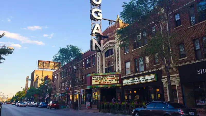
15. Clark Street In Andersonville
📍 N Clark St, between W Foster Ave and W Catalpa Ave, Chicago, IL 60640 (Andersonville)
The small-town main street tucked inside the city.
Clark Street between Foster and Catalpa is the commercial spine of Andersonville, a North Side neighborhood that traces back to Swedish immigrants who settled the area in the 1850s. The Swedish-American influence is still visible in the storefronts, the original Swedish Bakery sign on Clark (the bakery closed in February 2017 but is still remembered by a generation of locals), and the Swedish American Museum at 5211 N Clark.
The street has the feel of a small Wisconsin lake town, except it’s surrounded by Chicago.
Independent boutiques. Independent bookstores (Women & Children First, the largest feminist bookstore in the country, anchors the strip). Independent coffee. Independent restaurants. Almost no chains.
The Andersonville business owners actively organize to keep chain stores out of the neighborhood, and it’s worked for decades.
The street is also the heart of Chicago’s queer-friendly North Side residential scene. Andersonville is consistently ranked one of the most LGBTQ-friendly neighborhoods in the United States. Pride flags hang outside most businesses. Saturday mornings see the entire neighborhood out walking, brunching, and shopping.
Pro tip: Sunday morning is the calmest. Saturday late morning is the busiest. Brunch reservations at Big Jones, m.henry, or Hopleaf book up fast. The stretch between Foster and Bryn Mawr is the densest, most walkable section. Take the Red Line to Bryn Mawr.
The next street is the most strollable shopping corridor in Chicago, with a six-block stretch of Victorian buildings converted into high-end boutiques…
16. Armitage Avenue
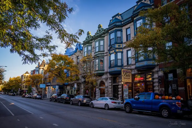
📍 W Armitage Ave, between N Halsted St and N Sheffield Ave, Chicago, IL 60614 (Lincoln Park)
The most strollable shopping street in Chicago.
Armitage Avenue between Halsted and Sheffield is a six-block stretch of Victorian buildings converted into high-end boutiques, third-wave coffee shops, restaurants, and one of the prettiest residential corridors in Lincoln Park.
The buildings are pure Victorian. Turrets. Bay windows. Ornamental brick. The kind of detailing that disappeared from new American architecture by 1920.
The shops inside are upscale but not pretentious. Independent women’s boutiques. Designer home stores. A few national brands like Lululemon, but nothing that overwhelms the local character. The buildings are protected by a Lincoln Park historic district designation, which means even when storefronts change hands, the architecture stays intact.
The DePaul University campus anchors the street’s western end. The Armitage CTA Brown Line stop puts you in the middle of the strip. Walking the full six blocks from Halsted to Sheffield takes about 30 minutes, and longer if you stop, which everyone does.
Pro tip: Saturday mornings are the most pleasant. Avoid Friday and Saturday nights when the bars on Halsted draw a younger, louder crowd. Stop at La Colombe under the Brown Line tracks for coffee, or grab a pastry at one of the local bakeries on the strip. Save Floriole Bakery (1220 W Webster Ave, 15 minutes north) for a separate Lincoln Park morning. It’s worth its own trip.
The last street on the list is Chicago’s largest open-air street art gallery, painted continuously since 1971, hidden under an elevated railroad viaduct…
17. Hubbard Street And The B_Line
📍 W Hubbard St, between N Halsted St and N May St, Chicago, IL 60607 (Fulton Market / West Loop)
The most strollable shopping street in Chicago.
Armitage Avenue between Halsted and Sheffield is a six-block stretch of Victorian buildings converted into high-end boutiques, third-wave coffee shops, restaurants, and one of the prettiest residential corridors in Lincoln Park.
The buildings are pure Victorian. Turrets. Bay windows. Ornamental brick. The kind of detailing that disappeared from new American architecture by 1920.
The shops inside are upscale but not pretentious. Independent women’s boutiques. Designer home stores. A few national brands like Lululemon, but nothing that overwhelms the local character. The buildings are protected by a Lincoln Park historic district designation, which means even when storefronts change hands, the architecture stays intact.
The DePaul University campus anchors the street’s western end. The Armitage CTA Brown Line stop puts you in the middle of the strip. Walking the full six blocks from Halsted to Sheffield takes about 30 minutes, and longer if you stop, which everyone does.
Pro tip: Saturday mornings are the most pleasant. Avoid Friday and Saturday nights when the bars on Halsted draw a younger, louder crowd. Stop at La Colombe under the Brown Line tracks for coffee, or grab a pastry at one of the local bakeries on the strip. Save Floriole Bakery (1220 W Webster Ave, 15 minutes north) for a separate Lincoln Park morning. It’s worth its own trip.
The last street on the list is Chicago’s largest open-air street art gallery, painted continuously since 1971, hidden under an elevated railroad viaduct…
The Bottom Line
Chicago is a city that rewards walking. The famous views are good. The lakefront. Michigan Avenue. The Riverwalk. They earned their reputation. But the real Chicago, the Chicago that locals love and that visitors leave thinking they’ve seen but actually missed, is in the residential blocks and the neighborhood boulevards and the streets with character that don’t make the front of the visitor guide.
If you only have time for one of these, walk Logan Boulevard from the Logan Square monument to Humboldt Park. You get the boulevard architecture, the Yellow Brick Road, and a sense of why locals love this city more than its reputation suggests.
If you have a full afternoon, build it around Hyde Park and the South Side. The Midway, Drexel Boulevard, and Rockefeller Chapel form one of the best self-guided walking tours in the city.
If you want to see Chicago the way Chicagoans see it, hop off the L at any neighborhood you’ve never been to. Walk three blocks east. Then three blocks west. Look up. The architecture will tell you the rest.

Thanks for making me feel at home once again. Lived in Chicago (Gold Coast) for many years, and am now living in LA. My heart still lives and will always live, in my beautiful Chicago!