On the morning of January 2, 1900, a small group of men in suits and overcoats stood beside a frozen dam on Chicago’s Southwest Side and attacked it with shovels.
They weren’t vandals. They were trustees of the Sanitary District of Chicago, and they were racing a lawsuit.
The state of Missouri was lining up a U.S. Supreme Court injunction to stop the project. If a judge got there first, eight years of digging and millions of dollars could be frozen in place.
They got there first. Within two weeks, the Chicago River was flowing away from Lake Michigan, and it has done so ever since.
 JM
AK
The River That Kept Flowing Into the Drinking Water
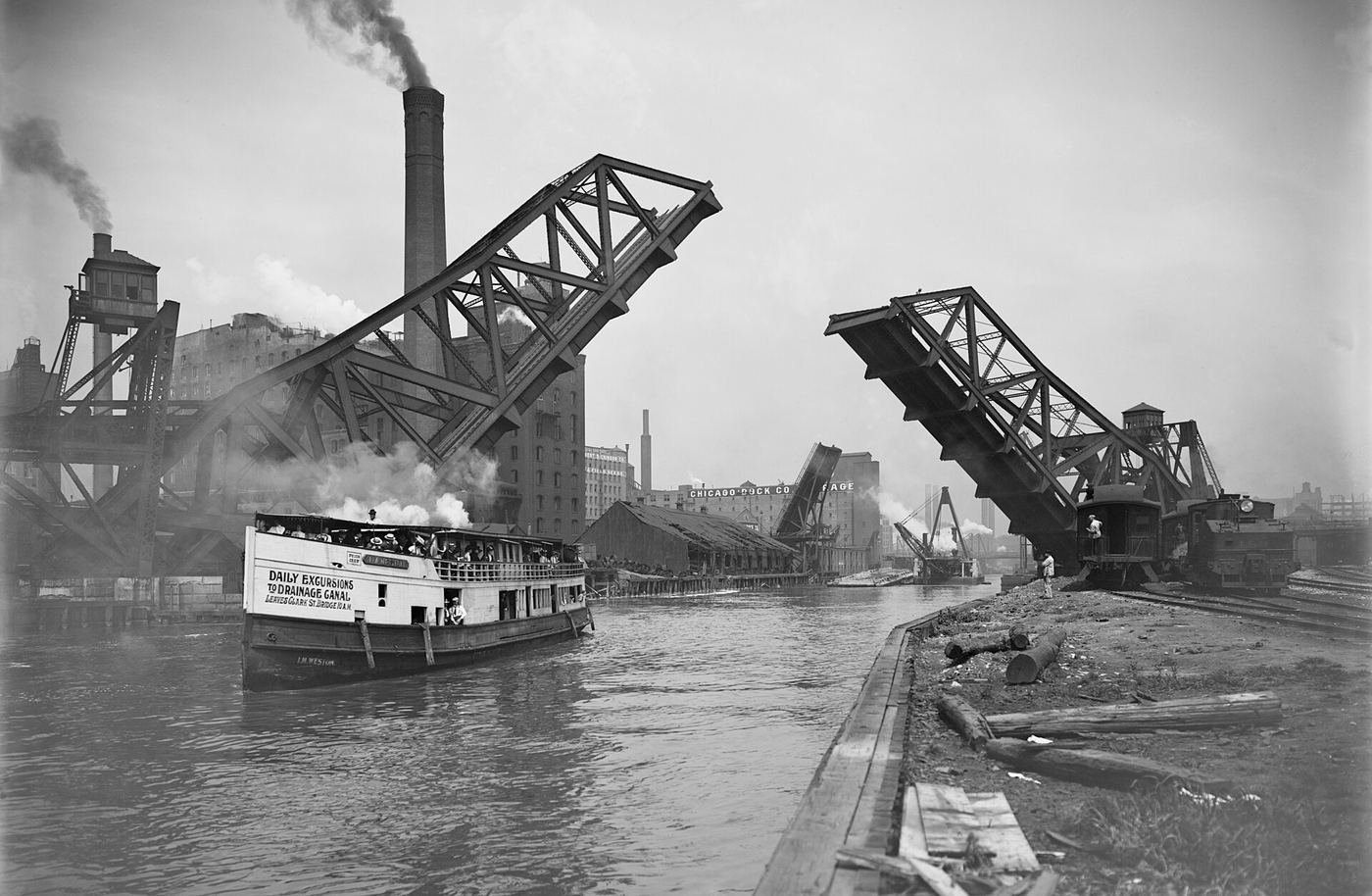
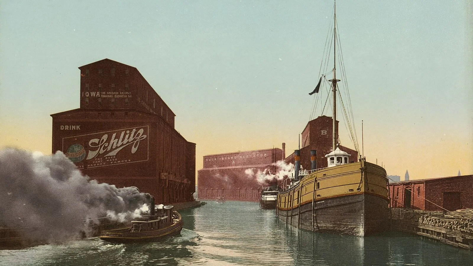
Nineteenth-century Chicago had a simple, disastrous plumbing plan. Sewers emptied into the Chicago River, the river emptied into Lake Michigan, and the lake was where the city got its drinking water, through intake cribs about two miles offshore.
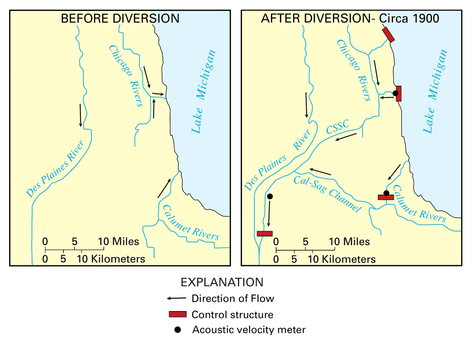
The first fix was to run the river the other way. By 1871, the Illinois & Michigan Canal had been deepened to pull river water west, away from the lake. It only worked some of the time. After a hard rain, the river simply slid back into the lake. In the wet summer of 1879, it flowed into the lake on 30 days in a row.
Then came August 2, 1885. More than five inches of rain fell in about 19 hours, the sewers overflowed, and the river carried filth far out into the lake. Chicago braced for disaster.
This is where the legend takes over. You may have heard that 90,000 people died of cholera and typhoid afterward. They didn’t. Researchers found no cholera deaths that year, and typhoid deaths never topped 1,000 in any year of the 1880s. Northeast winds probably kept the worst of it away from the intake, and the Chicago Tribune formally retracted the claim in 2005. It’s one of the urban legends that fall apart when you check the records.
What the storm did do was terrify the city. In 1889, voters created a new Sanitary District with one job: get Chicago’s sewage out of the lake for good.
The Biggest Dig in North America
Digging began on September 3, 1892, a day the district called Shovel Day, at Lemont.
The plan was to cut a 28-mile channel from the river’s South Branch to Lockport, deep enough that the water would run downhill over the low ridge between the Great Lakes and the Mississippi watersheds.
The numbers were enormous. Crews moved more than 40 million cubic yards of earth and rock, including about 12 million cubic yards of solid rock blasted out of a 15-mile stretch between Willow Springs and Lockport. The workforce peaked at 8,500 people. It was the largest earth-moving project North America had seen up to that point, and many of the engineers who learned on it later worked on the Panama Canal.
Eight years and roughly $33.5 million later (more than a billion dollars in today’s money), only one thing stood between the Chicago River and the new canal: a temporary dam of dirt.

The Frozen Dam and the Race Against the Courts
The dam sat near Kedzie Avenue, and the trouble was timing. St. Louis sits downstream on the Mississippi, and Missouri argued that Chicago was about to send its sewage to its doorstep. A court order could arrive at any moment.
So in the gray light of January 2, 1900, the trustees quietly gathered at the dam. There was one problem: the ground was frozen solid. Even dynamite barely moved the frozen clay.
Then two men came running toward the group. The trustees feared they were carrying an injunction. They were newspaper reporters who had been tipped off.
After about two hours of chipping, a contractor’s dredge finally cut through and the water flowed. A great shout went up from the crowd. The officials posed for a celebration photo and nearly got swept away by the rushing water.
The full flow wasn’t released until January 17, but the point of no return had passed. The river was running backward.
Did It Work? The Court Said “Prove It”
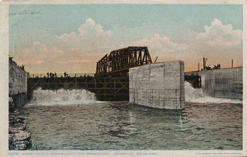
Missouri did sue. The state argued that Chicago’s sewage was giving St. Louis typhoid. In 1906, the Supreme Court dismissed the case. The justices said Missouri hadn’t proved it: the typhoid numbers were disputed, experts disagreed on whether the germs could survive a 357-mile trip down the rivers, and Missouri’s own towns were dumping sewage into the Mississippi too.
Back home, the results were hard to argue with. An expert interviewed for WTTW’s Chicago Stories says deaths from waterborne diseases fell by between a third and a half, and that Chicago went “from being one of the least healthy cities to one of the healthiest.”
The project kept growing, too. In 1938, the Chicago Harbor Lock was finished at the river’s mouth. Today it keeps the lake and river apart, with the lake usually sitting two to five feet higher than the river.
One last twist: the reversal isn’t absolute. During extreme storms, when the river rises too high, crews can open the gates and let it flow into the lake again as a last resort. The river that was made to run backward still gets a say. It has surprised the city before, as the 1992 Loop flood proved.
The Reversed River Visitor Guide
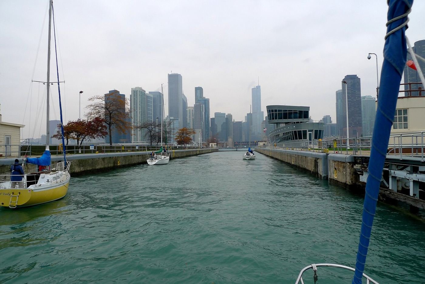
Chicago Harbor Lock:
Walk to the lakefront beside Navy Pier and watch boats rise or drop between the river and the lake. The lock chamber is 600 feet long and 80 feet wide, and a full cycle takes roughly 15 minutes. On a busy summer day, dozens of boats lock through at once.
Address: 108 N. Streeter Dr., Chicago, IL 60611.
Cost: Free to watch. The lock is run by the U.S. Army Corps of Engineers.
The Gaylord Building, Lockport:
The canal ends roughly 30 miles southwest of downtown, in Lockport. The Gaylord Building’s first-floor gallery has a permanent exhibit on the Illinois & Michigan Canal, the older waterway this one largely replaced.
Address: 200 W. 8th St., Lockport, IL 60441.
Hours: Tuesday to Friday 9 a.m. to 5 p.m., weekends noon to 5 p.m., closed Mondays. Check before you go.
Want more Chicago stories like this one? Join the free Hey Chicago newsletter at newsletter.heychicago.us.
Historical details sourced via the Encyclopedia of Chicago, Library of Congress HAER documentation, WTTW Chicago Stories, the U.S. Army Corps of Engineers and the U.S. Supreme Court record. Images: featured photochrom and bridge photo, Detroit Publishing Co. via the Library of Congress (public domain); butterfly dam postcard, Newberry Library (public domain); map, U.S. Geological Survey (public domain); Harbor Lock photo, David B. Gleason (CC BY-SA 2.0).
JM
AK