Chicago is arguably one of the most stunningly designed cities in North America.
Yet, the average visitor only ever sees about five percent of it. They marvel at the downtown skyline, stroll down Michigan Avenue, snap a quick selfie at the Bean in Millennium Park, and head straight back to O’Hare.
But the real beauty of Chicago lies tucked away in its 77 distinct, fiercely independent communities. In fact, if you want to see where residents actually spend their weekends, you should check out our guide to the 9 Chicago neighborhoods where locals actually hang out.
Each community has its own architectural personality, lush tree canopies, and quiet residential blocks that locals cherish as the prettiest in town.
From sprawling Gilded Age mansions on the historic South Side to a literal yellow brick road hiding in Humboldt Park, Chicago’s streets are packed with deep history, dramatic resilience, and undeniable charm.
Whether you’re looking for iconic postcard skylines, leafy European-style boulevards, or vibrant cultural corridors, we’ve completely updated this ultimate guide for 2026.
Whether you live here or are trying to build the perfect 3-day itinerary in Chicago, here are the 17 most beautiful streets in the city, packed with rich history and insider pro tips!
1. DuSable Lake Shore Drive
📍 Location: Along Lake Michigan from Hollywood Ave (north) to 67th St (south)
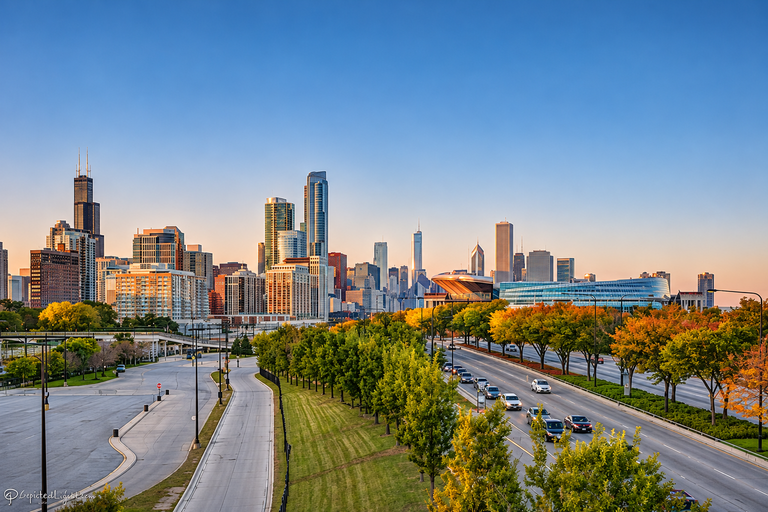
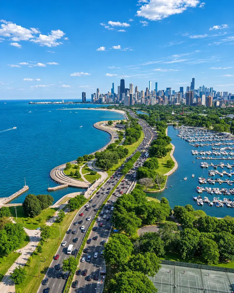
This is hands-down the most cinematic urban drive in America.
Stretching an impressive 17 miles along the western edge of Lake Michigan, it offers a towering, glittering skyline on one side and an ocean-like, endless lake on the other.
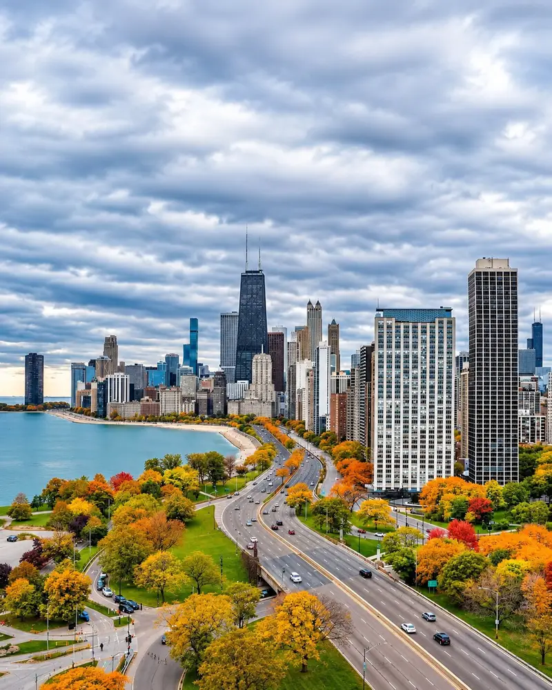
Renamed in 2021 to honor Jean Baptiste Point DuSable—the Haitian-born founder of Chicago—locals still affectionately and stubbornly just call it “The Drive.”
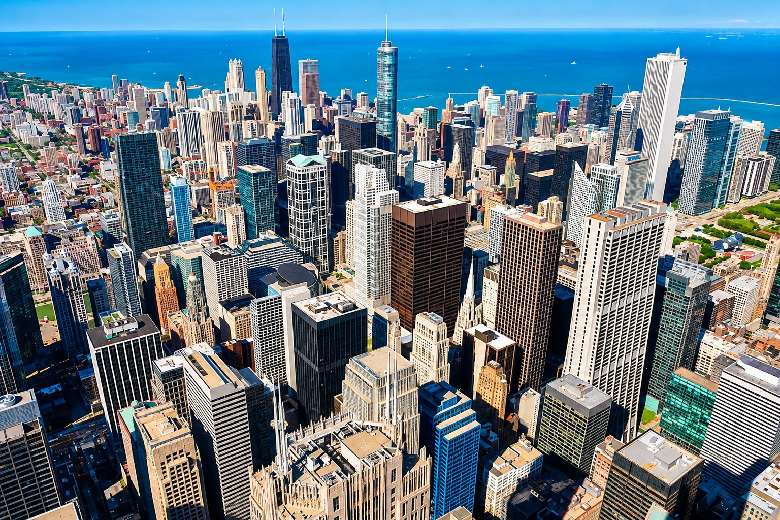
The northbound stretch between Roosevelt Road and Belmont Avenue provides the ultimate postcard view, especially as the black steel of the John Hancock building looms dramatically overhead near the famous Oak Street Beach curve.
Deep Dive History:
Much of the land you drive on didn’t exist a century ago. The northern section of the drive was built on landfill, largely driven by the eccentric “Captain” George Wellington Streeter, who illegally ran his boat aground in the late 1800s and declared the resulting sandbar an independent nation.
It sounds crazy, but it’s just one of those facts about Chicago that sound made up but are completely true.
This 4K walking tour highlights the 18.5-mile, entirely car-free Lakefront Trail that runs parallel to the Drive, providing a safe and heavily trafficked route for local runners and cyclists.
- Interesting Fact: The famous “S-Curve” near the Chicago River used to be so sharp and dangerous that it was entirely rebuilt and straightened in the 1980s to stop cars from careening off the road in the winter.
- How To Get There: Take the CTA Bus 147 (The Outer Drive Express), which runs the length of the North Side stretch.
- Best Time To Go: Drive it once at dusk and once at midnight. The contrast of the city lights reflecting off the lake is spectacular.
- 📸 Best Photo Spot: Walk out to the pedestrian bridge at North Avenue Beach and shoot south toward the skyline. The curvature of the beach perfectly frames the skyscrapers.
- Expanded Pro Tip: You don’t need a car to enjoy it! The Lakefront Trail runs parallel for 18.5 miles, entirely car-free. If you’re wondering is Chicago actually safe for tourists, this path is heavily trafficked and very secure during daylight hours. If you are driving, check SpotHero in advance for garages near the lakefront, as street parking is virtually non-existent.
- 🏨 Where to Stay Nearby: The Drake Hotel. Located right where The Drive meets the Magnificent Mile, this historic hotel offers breathtaking views of Oak Street Beach.
2. Michigan Avenue (The Magnificent Mile)
📍 Location: N Michigan Ave, from the Chicago River north to Oak St
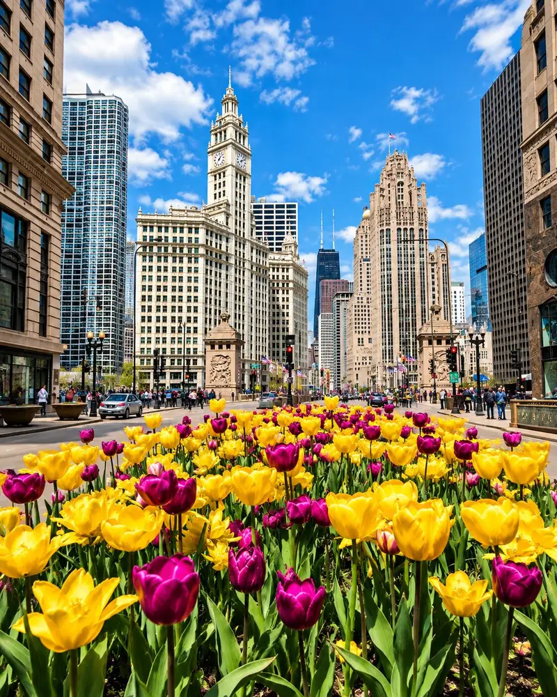
This is the most famous mile in the Midwest, and for good reason.
While born-and-raised locals might sometimes dismiss it as a crowded tourist trap, the historic architecture between Oak Street and the Chicago River is genuinely extraordinary.
Any walk down this full mile produces one of the great urban architectural walking experiences in the world. Look out for the gleaming white terra cotta of the Wrigley Building (1924) and the stunning neo-Gothic flying buttresses of the Tribune Tower (1925).
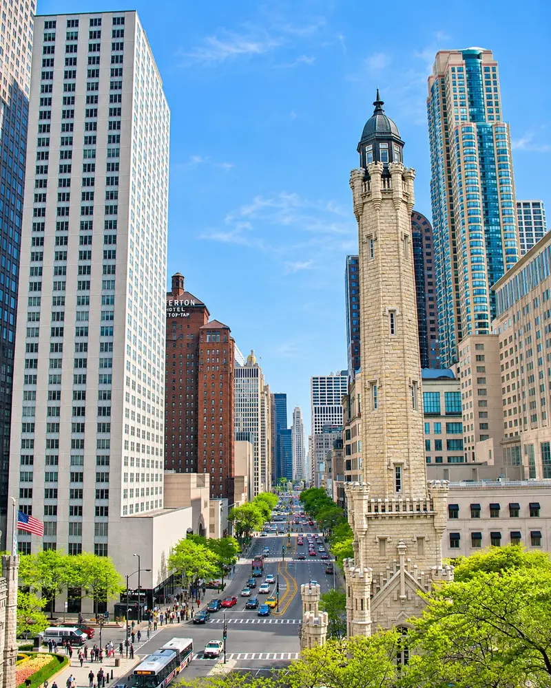
If you step inside some of these historic structures, you’ll also find a few of the most stunning lobbies in Chicago you can experience for free.
Deep Dive History:
Michigan Avenue wasn’t always this grand. It used to be a narrow, dusty residential street called Pine Street. It wasn’t until the opening of the DuSable Bridge in 1920 that the street was dramatically widened, transforming it into the commercial powerhouse we know today.
Look closely at the base of the Tribune Tower featured in this walk—it contains over 150 physical fragments of global history embedded in its walls, including stones from the Great Wall of China and the Taj Mahal.
- Interesting Fact: Look closely at the base of the Tribune Tower. It has over 150 historical stones embedded in its facade, including pieces from the Parthenon, the Great Wall of China, the Taj Mahal, and the Alamo.
- How To Get There: Red Line CTA to Chicago or Grand stations.
- Best Time To Go: November through January. The magical holiday lights stay on through early February, and the festive atmosphere makes the heavy crowds totally worth it.
- 📸 Best Photo Spot: The DuSable (Michigan Avenue) Bridge. Stand on the southeast corner looking north for a stunning shot of the Wrigley Building and Tribune Tower framing the avenue.
- Expanded Pro Tip: Skip the expensive observation decks. Many of the best downtown Chicago hotels are clustered right along this stretch and offer incredible rooftop bars. Head to the LondonHouse Chicago rooftop for an unobstructed, eye-level view of the river.
- 🏨 Where to Stay Nearby: InterContinental Chicago Magnificent Mile. A classic luxury hotel that puts you right in the center of the shopping district with a stunning historic indoor pool.
 JM
AK
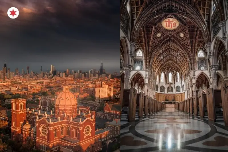
3. The Canyon Of LaSalle Street
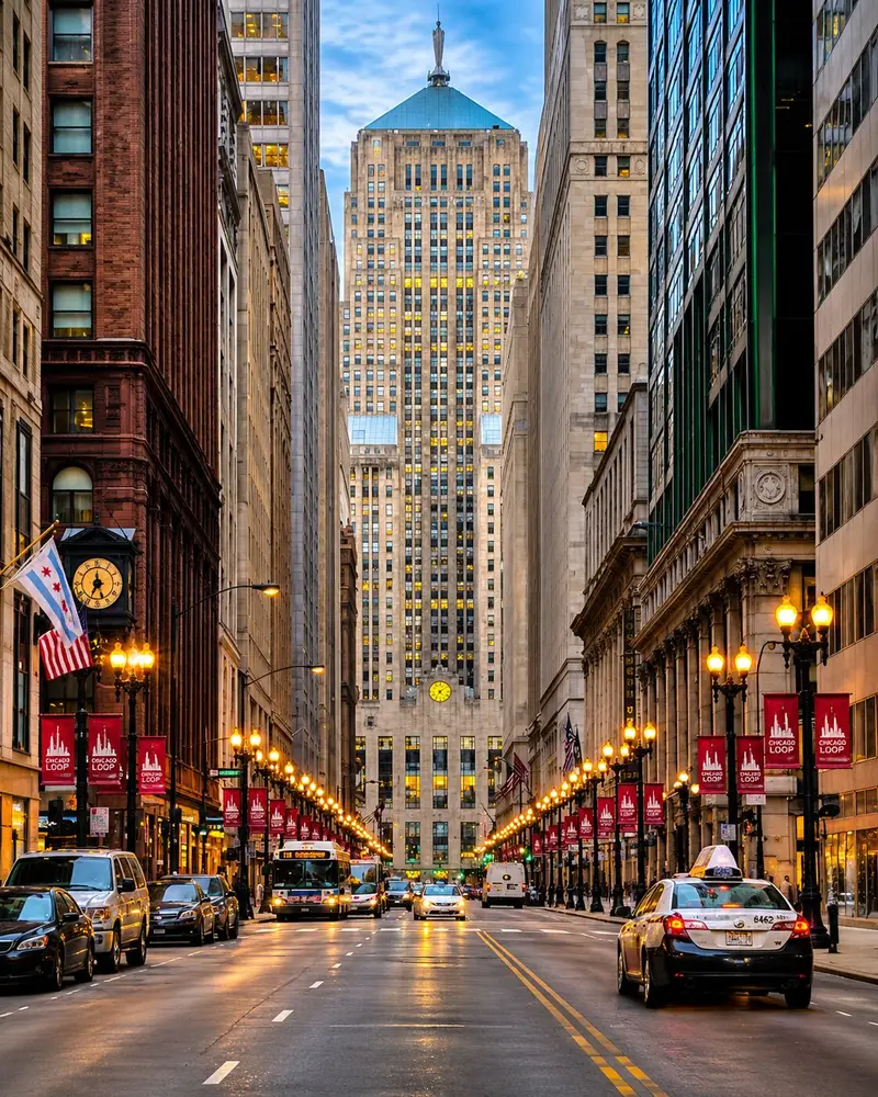
📍 Location: S LaSalle St, looking south from W Madison St to W Jackson Blvd
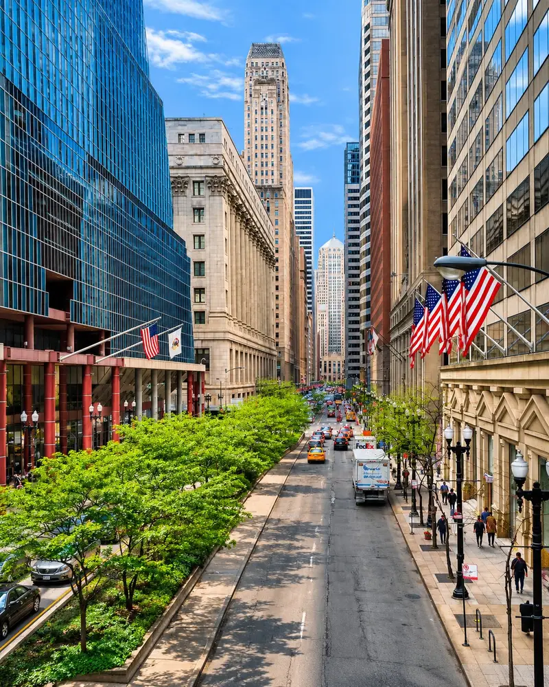
Stand on LaSalle Street between Madison and Monroe, look south, and prepare to have your breath taken away.
The street artificially narrows here, and the dark, imposing skyscrapers rise up like towering canyon walls on either side, blocking out the sun.
At the very end of the street sits the Chicago Board of Trade Building, perfectly framing a view that appears in almost every Chicago architecture textbook. It forms a breathtaking canyon of some of the 14 most iconic buildings in Chicago.
Deep Dive History:
This stretch is the historic financial heart of the Midwest. During the roaring 1920s, banks built massive, fortress-like structures here to project wealth and security. But beneath the wealth, a few of these financial fortresses are actually normal-looking Chicago buildings that hide a very dark history of mobsters and market crashes.
- Interesting Fact: Look at the very top of the Board of Trade building. You’ll see an aluminum statue of Ceres, the Roman goddess of agriculture. The sculptor left her face entirely blank because he assumed no other building would ever be built tall enough for anyone to see it!
- How To Get There: Brown, Orange, Pink, or Purple CTA lines to Quincy, or the Blue Line to Jackson.
- Best Time To Go: Golden hour. The western light perfectly hits the limestone facades and makes the art deco details glow.
- 📸 Best Photo Spot: The dead center of the crosswalk at LaSalle and Adams. Wait for the walk signal, step into the middle, and shoot straight south.
- Expanded Pro Tip: Take your photos on a Sunday morning when banking traffic is non-existent. Film buffs take note: this is the exact street where Batman flipped the Joker’s semi-truck in The Dark Knight.
- 🏨 Where to Stay Nearby: JW Marriott Chicago. Located directly in the financial district, this upscale hotel boasts massive marble bathrooms and a gorgeous lobby.
4. Wacker Drive And The Riverwalk
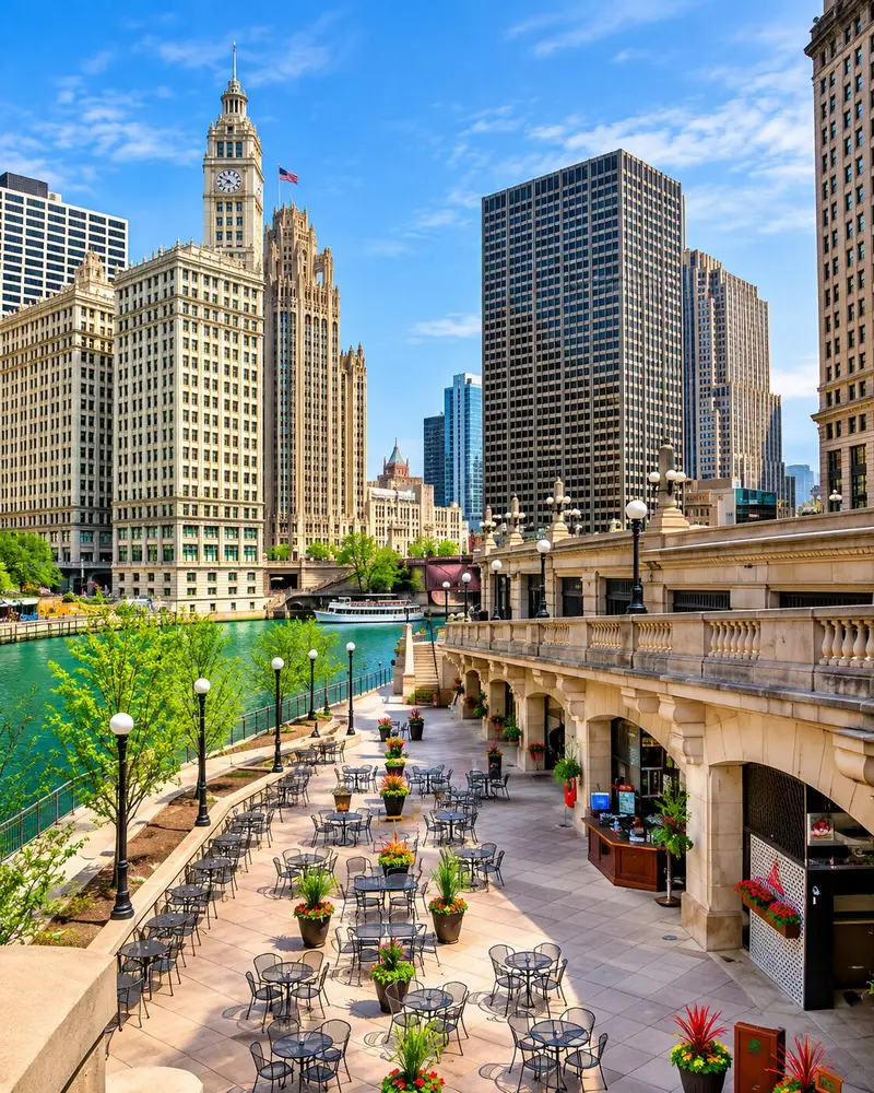
📍 Location: E Wacker Dr along the Chicago River, from Lake Michigan to Lake St
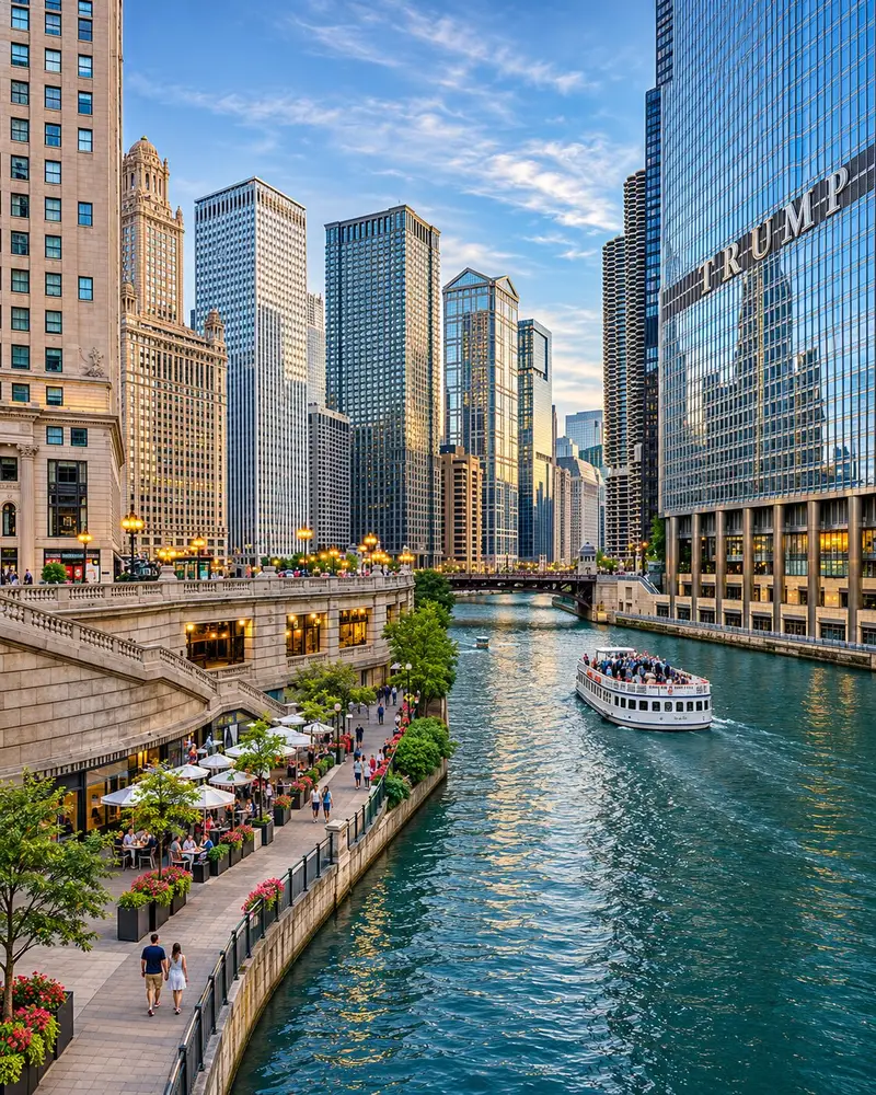
Upper and Lower Wacker Drive offer the quintessential modern Chicago postcard view.
Steel, glass, and limestone reflect beautifully in the water, with Marina City’s famous “corn cob” towers anchoring the riverbanks.
The Chicago Riverwalk runs along the south bank for 1.25 miles and has recently been expanded into one of the best public downtown spaces in America.
Deep Dive History:
Wacker Drive is a massive engineering marvel. It is a double-decker (and in some places, triple-decker) street envisioned in Daniel Burnham’s famous 1909 Plan of Chicago. Upper Wacker handles local traffic and pedestrians, while Lower Wacker is a dark labyrinth used by delivery trucks, garbage services, and locals trying to bypass traffic.
- Interesting Fact: The river you are looking at flows backwards. In 1900, engineers famously reversed the flow of the Chicago River to carry sewage away from Lake Michigan (the city’s drinking water source) and down toward the Mississippi River.
- How To Get There: Any CTA train into the Loop (State/Lake or Clark/Lake stops).
- Best Time To Go: Summer nights between 10 PM and midnight when the crowds clear, and the dark water perfectly reflects the lit-up skyscrapers.
- 📸 Best Photo Spot: The State Street Bridge looking east. It captures the bend of the river, the shiny Trump Tower, and the Wrigley Building all at once.
- Expanded Pro Tip: While walking is great, viewing Wacker Drive from the water is better. We highly recommend booking one of the 5 Chicago architecture boat tours locals actually recommend. Afterward, grab dinner at one of the best Chicago restaurants with a view overlooking the water.
- 🏨 Where to Stay Nearby: Swissôtel Chicago. Located right where the river meets the lake, offering arguably the best dual-view rooms in the entire city.
5. Logan And Kedzie Boulevards
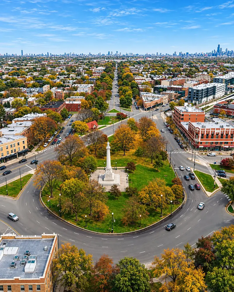
📍 Location: N Logan Blvd and N Kedzie Blvd around Logan Square
In the 1870s, Chicago designed a 28-mile ring of lushly planted boulevards to connect its parks, known as the “Emerald Necklace.”
Today, Logan and Kedzie Boulevards represent the most beautifully surviving heart of this historic district.
Wide grassy medians divide the roads, while mature trees form a continuous, leafy canopy over 130-year-old greystones and massive Queen Anne mansions.
Deep Dive History:
These boulevards were initially paved for horse-drawn carriages, but in the 1890s, they became the epicenter of Chicago’s massive bicycle craze. Thousands of cyclists would ride these boulevards on weekends. The iconic “greystone” houses lining the street are made of Bedford limestone, which is Chicago’s unique architectural answer to the New York brownstone.
- Interesting Fact: At the intersection of these two boulevards stands the Illinois Centennial Monument (1918), a 70-foot Doric column designed by Henry Bacon—the same architect who designed the Lincoln Memorial in Washington D.C.
- How To Get There: Blue Line CTA to Logan Square.
- Best Time To Go: Sunday mornings from May through October to catch the vibrant community energy.
- 📸 Best Photo Spot: Stand on the grassy median of Logan Boulevard, looking straight toward the towering eagle of the Centennial Monument.
- Expanded Pro Tip: This is a perfect place to rent a Divvy bike (Chicago’s bike-share system). Grab a bike and cruise the protected lanes. While walking here, you might hear some Chicago slang terms that’ll make you sound like an actual local. Pair your walk with the Logan Square Farmers Market, and then grab food at one of the neighborhood’s 12 wildly famous Chicago restaurants that are actually worth the hype.
- 🏨 Where to Stay Nearby: The Robey. Located just a couple of train stops away in Wicker Park, this art deco tower is the trendiest boutique hotel on the Northwest Side.
6. Humboldt Boulevard (The Yellow Brick Road)
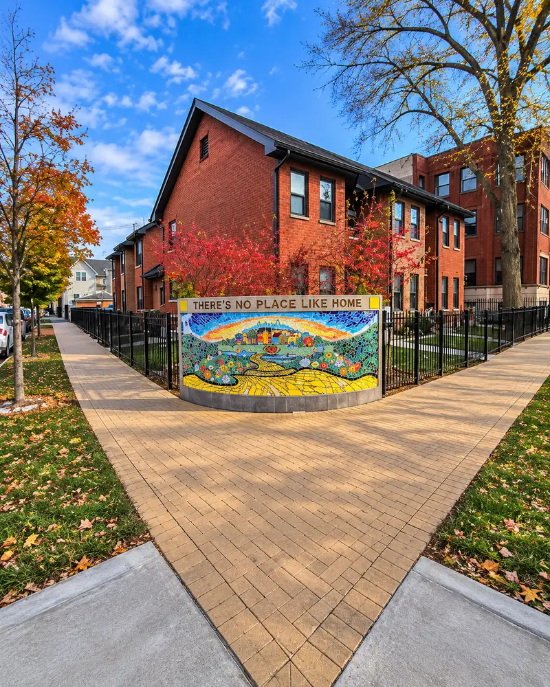
📍 Location: N Humboldt Blvd, between Cortland St and Wabansia Ave
This is the most underrated and magical stretch of the historic Emerald Necklace.
Humboldt Boulevard is lined with sprawling, single-family Gilded Age mansions originally built for 19th-century German and Scandinavian industrialists.
But the real secret lies at the southern end, right at the corner of Humboldt and Wabansia. Finding it is easily one of the most 10 unusual things to do in Chicago that tourists always miss.
Deep Dive History:
Before Hollywood got hold of it, The Wizard of Oz was a purely Chicago creation. Author L. Frank Baum lived in a house on this exact street in 1899. He was heavily inspired by the nearby 1893 World’s Columbian Exposition (which featured stunning white buildings that inspired the Emerald City) and the yellow paving bricks common in the area.
- Interesting Fact: Baum’s original home is no longer there, but in its place, a local non-profit developer paved a 200-foot “Yellow Brick Road” sidewalk alongside a stunning tile mosaic to commemorate where he wrote the beloved American fairy tale.
- How To Get There: Blue Line CTA to Damen, then a short walk or bus ride west.
- Best Time To Go: Mid-afternoon. The sun perfectly catches the colorful tile work of the Oz mosaic.
- 📸 Best Photo Spot: Right on the corner of Wabansia and Humboldt, where the Yellow Brick Road mosaic features Dorothy’s Ruby Slippers.
- Expanded Pro Tip: This is a very quiet residential block. Take your photos of Toto and the Yellow Brick Road, but be respectful of the locals living there. Afterward, walk south into Humboldt Park itself to see the stunning historic boathouse and lagoon.
- 🏨 Where to Stay Nearby: The Ruby Room. A unique, wellness-focused boutique inn located a short distance away in Wicker Park.
7. Drexel Boulevard
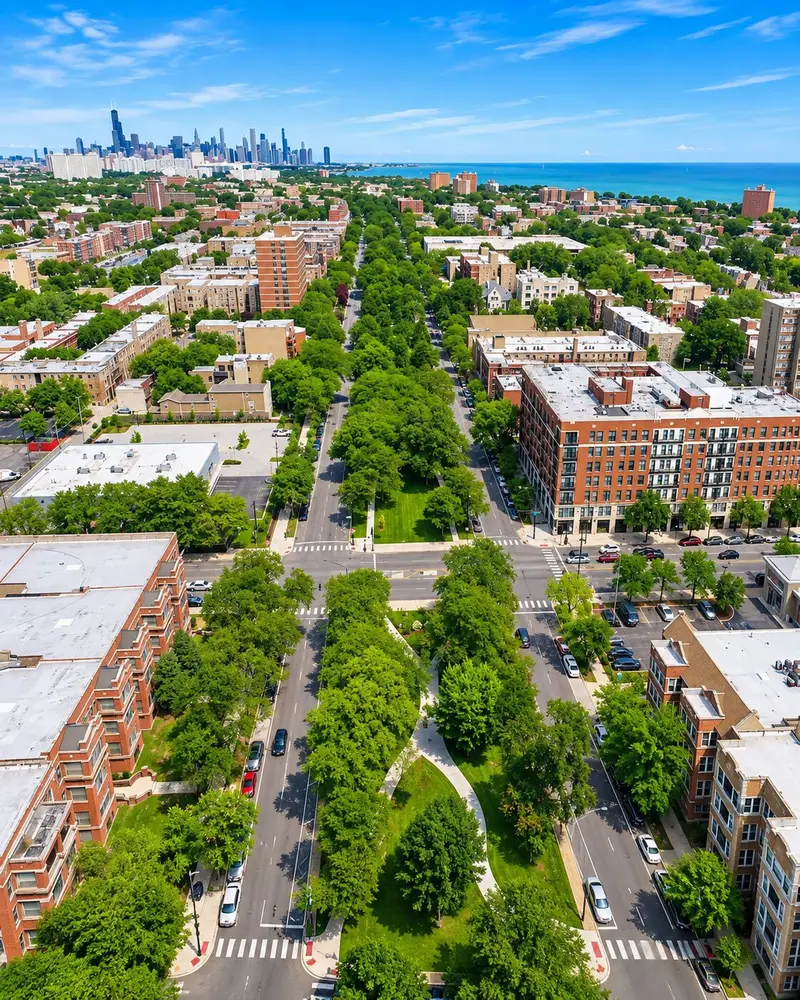
📍 Location: S Drexel Blvd, between 39th St and 51st St (Bronzeville)
Drexel Boulevard is the historic South Side’s spectacular version of the Emerald Necklace.
Running through the heart of Bronzeville—often referred to as Chicago’s historic Black metropolis—the street features extra-wide grassy medians, lush gardens, and jaw-dropping ornate mansions.
It is widely considered one of Chicago’s hidden gems that locals say you need to see.
Deep Dive History:
Originally built for wealthy white meatpacking and railroad executives in the late 1800s, the demographics shifted dramatically during the Great Migration. Between 1910 and 1970, millions of Black Americans fled the Jim Crow South, and Bronzeville became a thriving center for Chicago’s Black professional class, artists, and intellectuals.
- Interesting Fact: Jazz legend Louis Armstrong, pioneering aviator Bessie Coleman, and civil rights activist Ida B. Wells all lived within blocks of this boulevard.
- How To Get There: Green Line CTA to 43rd or 47th stops.
- Best Time To Go: Spring or summer mornings to enjoy the lush greenery and blooming median gardens.
- 📸 Best Photo Spot: The 4900 block of S Drexel, looking at the McGill House. It looks like a literal French Renaissance chateau dropped into the city.
- Expanded Pro Tip: Make a full day of it by walking the Bronzeville Walk of Fame on King Drive. If you are driving down here, street parking is actually quite easy and mostly free, unlike the North Side!
- 🏨 Where to Stay Nearby: Sophy Hyde Park. A beautiful, luxury boutique hotel just a short drive south, deeply inspired by the art and music of the South Side.
8. Alta Vista Terrace
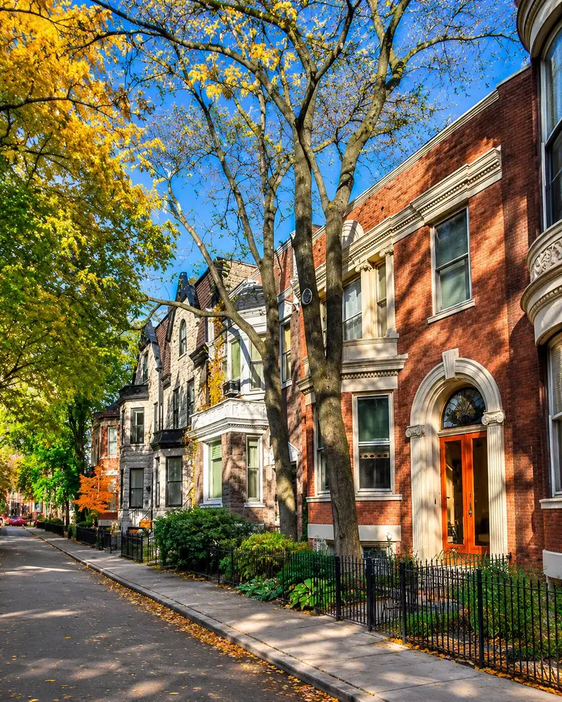
📍 Location: N Alta Vista Terrace, between Byron St and Grace St (Lakeview)
Known beautifully as “The Street of Forty Doors,” this single block hiding just steps away from Wrigley Field is genuinely unlike anywhere else in America.
Stepping onto this street feels like you’ve been teleported across the Atlantic.
There are twenty distinctly Roman-style brick row houses on each side, featuring beautiful bay windows, ornate cornices, and colorful front doors.
Deep Dive History:
Developer Samuel Gross visited Europe in the late 1890s and was so captivated by Mayfair Terrace in London that he decided to replicate it in Chicago. Built between 1900 and 1904, Gross implemented incredibly strict architectural covenants to ensure the street could never be altered or demolished.
- Interesting Fact: Here is the architectural twist: each house heavily mirrors its counterpart diagonally across the street, rather than directly across! It was designated as Chicago’s very first historic district back in 1971.
- How To Get There: Red Line CTA to Addison, then walk a few blocks north.
- Best Time To Go: Late afternoon. The east-facing houses perfectly catch the golden western light, making the brickwork glow.
- 📸 Best Photo Spot: Stand at the very south entrance on Byron Street and shoot straight down the block to capture the matching diagonal rooflines.
- Expanded Pro Tip: Visit on a day when the Cubs are not playing baseball. The street is incredibly narrow, so if you’re a photographer, bring a wide-angle lens. Parking here is residential permit only, so use SpotHero to find a garage on Clark Street if you must drive.
- 🏨 Where to Stay Nearby: Hotel Zachary. A gorgeous, baseball-inspired boutique hotel located right across the street from Wrigley Field.
9. Midway Plaisance
📍 Location: Midway Plaisance, between Washington Park and Jackson Park (Hyde Park)
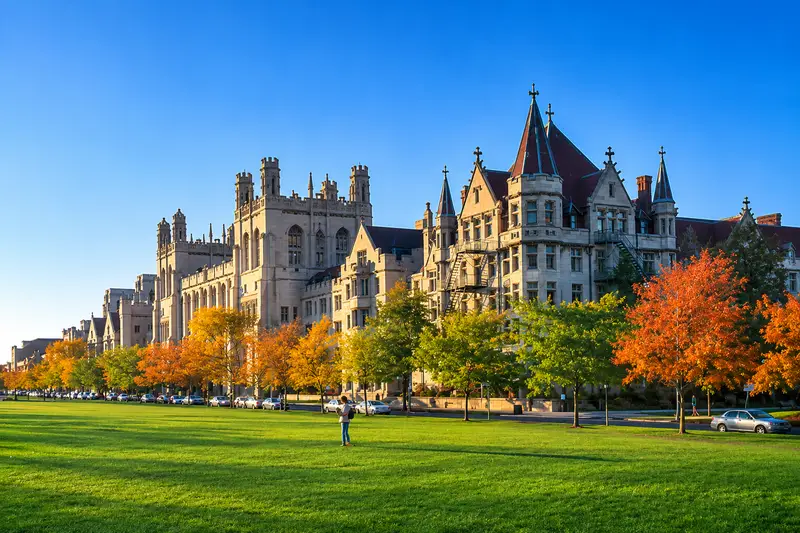
Designed by the legendary Frederick Law Olmsted (the visionary architect behind New York’s Central Park), this massive one-mile stretch of sunken green space connects Washington and Jackson Parks.
Today, it acts as the stunning, sprawling centerpiece of the University of Chicago campus. It’s undeniably one of the best 10 places in Chicago to escape the city without ever leaving it.
Surrounded by towering Collegiate Gothic buildings covered in ivy, the area feels much more like Oxford or Cambridge than the South Side of Chicago.
Deep Dive History:
If you’ve ever read The Devil in the White City, this is where it happened. This exact stretch was the wildly popular “pleasure ground” of the 1893 World’s Columbian Exposition. While the main fair was formal, the Midway was loud, chaotic, and incredibly fun.
- Interesting Fact: The Midway Plaisance hosted the world’s very first Ferris Wheel! It was an absolute monster, standing 264 feet tall, with cars the size of actual buses that held 60 people each.
- How To Get There: Metra Electric Line to 59th St. (University of Chicago).
- Best Time To Go: Winter for the free public ice skating rink, or autumn when the campus trees turn brilliant shades of orange and red.
- 📸 Best Photo Spot: The western edge of the Midway facing the massive, haunting Fountain of Time sculpture by Lorado Taft.
- Expanded Pro Tip: Don’t miss Rockefeller Memorial Chapel, just a 5-minute walk away. It easily ranks among the 16 famous churches in Chicago that look like European cathedrals.
- 🏨 Where to Stay Nearby: The Study at University of Chicago. A bright, literary-themed hotel located right on the campus grounds.
10. Astor Street
📍 Location: N Astor St, between W North Ave and W Division St (Gold Coast)
Astor Street is widely, and rightfully, considered the most prestigious residential street in Chicago.
Located in the ultra-wealthy heart of the Gold Coast, it is lined with late 19th-century brownstones, townhouses, and massive mansions that scream old money.
You’ll spot early, groundbreaking designs by Frank Lloyd Wright and the sprawling rear grounds and coach house of the towering Archbishop’s Residence (a 19-chimney mansion housing every Cardinal Archbishop of Chicago since 1885 that stretches all the way to State Parkway).
Deep Dive History:
Before the 1880s, the Gold Coast was basically a swamp. But when millionaire Potter Palmer built a massive, castle-like mansion on Lake Shore Drive, the rest of Chicago’s elite quickly abandoned the South Side and followed him north, building the Astor Street we see today.
- Interesting Fact: Look down at the street itself where Astor meets Goethe Street. You’ll see a small patch of original wooden block paving exposed! Chicago used to pave its streets with wood before the Great Fire.
- How To Get There: Red Line CTA to Clark/Division.
- Best Time To Go: In the rain or snow! Locals swear by it.
- 📸 Best Photo Spot: The Charnley-Persky House at 1365 N Astor. Designed by Louis Sullivan and Frank Lloyd Wright in 1891, it’s a masterpiece of modern architecture.
- Expanded Pro Tip: Walk here in October or April at dusk. The historic gas lamps turn on, and their flickering reflection on the wet brick streets feels straight out of a Victorian movie. If you work up an appetite walking among the mansions, head nearby to grab dinner at one of the best steakhouses in Chicago.
- 🏨 Where to Stay Nearby: Ambassador Chicago. A glamorous, historic hotel tucked quietly into the Gold Coast neighborhood that used to host Frank Sinatra and Marilyn Monroe.
11. Hutchinson Street
📍 Location: W Hutchinson St, between N Marine Dr and N Hazel St (Buena Park)
Hutchinson Street holds one of the finest, most perfectly preserved hidden collections of Prairie School architecture in Chicago.
Located in a tiny, heavily wooded pocket of Uptown known as Buena Park, the street is defined by its strong horizontal lines, expansive porches, and massive, sloping lawns.
It feels more like a quiet suburb in Oak Park than a street located just blocks from the chaotic lakefront.
Deep Dive History:
In the late 1800s, Buena Park was designed as a forested retreat for the wealthy to escape the dirt and grime of downtown Chicago. Most of the massive mansions here were designed between 1890 and 1920 by George W. Maher, a famous contemporary (and rival) of Frank Lloyd Wright.
- Interesting Fact: Maher’s 1913 design for jeweler Claude Seymour (at 4274 N Hutchinson) is a jaw-dropping 12,000-square-foot mega-residence that takes up five standard city lots!
- How To Get There: Red Line CTA to Sheridan, walk north to Buena, then east.
- Best Time To Go: Early weekend mornings for a quiet, tree-canopied stroll with a cup of coffee.
- 📸 Best Photo Spot: Stand across the street from the Seymour mansion to capture its sheer, imposing width and striking horizontal Prairie lines.
- Expanded Pro Tip: Check the Buena Park Neighbors website during the summer for free walking tours led by highly knowledgeable local docents. And while you are in the Uptown neighborhood, don’t miss the historic entertainment district—especially since the legendary Uptown Theatre reopens for Open House Chicago 2026!
- 🏨 Where to Stay Nearby: The Guesthouse Hotel. A highly rated, family-friendly boutique hotel located slightly north in Andersonville.
12. The Villa District
📍 Location: Between W Addison St and W Avondale Ave, around N Pulaski Rd (Avondale)
This hidden neighborhood feels entirely separate from Chicago because it was deliberately built completely off the traditional city grid.
Developed between 1907 and 1922, The Villa is a meticulously planned community filled with incredibly intact Craftsman bungalows, American foursquares, and Tudor revivals.
Instead of long grid blocks, you’ll find winding, curving streets, unexpected triangular grassy parkways, and massive historic front porches.
Deep Dive History:
The Villa was heavily marketed to upwardly mobile Polish and Eastern European immigrants who were moving out of the crowded tenements of Wicker Park. The wide, boulevard-style parkways were designed to give working-class families a taste of upper-class suburban living within the city limits.
- Interesting Fact: Because of the strict neighborhood preservation rules, almost all the homes look exactly as they did in 1915!
- How To Get There: Blue Line CTA to Addison, then take the Addison bus west to Pulaski.
- Best Time To Go: Lunchtime during the week when the neighborhood is whisper-quiet.
- 📸 Best Photo Spot: The historic stone entrance arches at the corner of N Pulaski Road and W Addison Street.
- Expanded Pro Tip: Because of the area’s rich working-class history, you absolutely must grab food afterward. It’s the perfect excuse to hunt down the 14 absolute best Italian Beefs in Chicago located nearby.
- 🏨 Where to Stay Nearby: City Suites Hotel. Avondale is mostly residential, so booking this cozy hotel in nearby Belmont is your best bet for easy access via the CTA.
13. Greenview Avenue
📍 Location: N Greenview Ave, between W Addison St and W Irving Park Rd (Lakeview)
Locals consistently rank this as the most underrated residential street on the North Side—and many asked for it to remain a secret!
This gorgeous five-block stretch features massive Victorian and Queen Anne estates set unusually far back from the street, boasting expansive lawns and massive wraparound porches.
In the summer, the century-old mature trees arch entirely over the road to form a lush, complete green tunnel.
Deep Dive History:
Before the L train was built in the 1890s, the Lakeview neighborhood was entirely rural. As the city expanded, wealthy merchants bought up these large farming plots to build sprawling country homes that were eventually swallowed by the expanding city.
- Interesting Fact: The lots here are much wider than standard Chicago lots (which are typically a narrow 25 feet wide). Because of this, the houses are so expansive they read more like country estates than tight urban homes.
- How To Get There: Red Line CTA to Sheridan or Addison.
- Best Time To Go: Autumn. The massive tree canopy turns brilliant, fiery shades of gold and red, making it a photographer’s dream.
- 📸 Best Photo Spot: Stand in the middle of the sidewalk near the intersection of Greenview and Grace. The tree canopy here forms a perfect, unbroken arch overhead.
- Expanded Pro Tip: Avoid walking this street on Cubs game days, as the area turns into a chaotic, honking parking lot. Walk this quiet stretch in the evening before retreating to one of the 12 best speakeasies in Chicago to cap off your night.
- 🏨 Where to Stay Nearby: The Majestic Hotel. A classic, English-manor style boutique hotel tucked into the quiet residential streets of East Lakeview.
14. 18th Street In Pilsen
📍 Location: W 18th St, between S Ashland Ave and S Halsted St
Welcome to the most colorful, vibrant, and culturally rich street in Chicago.
As the commercial heart of the historically Mexican-American Pilsen neighborhood, 18th Street is a total sensory experience of sights, sounds, and incredible smells.
The 19th-century buildings are painted in vivid magenta, canary yellow, and cobalt blue, with stunning, politically charged street murals turning the corridor into a massive open-air gallery. It’s a must-read section for anyone following our local’s guide to Chicago’s best public art.
Deep Dive History:
Pilsen was originally settled by Bohemian and Czech immigrants in the late 1800s. In the 1960s, a massive influx of Mexican immigrants displaced by university construction moved in, transforming it into the cultural powerhouse it is today.
- Interesting Fact: Just a quick two-block detour south on Cullerton Street, renowned muralist Hector Duarte painted one of the most famous pieces in the neighborhood—a massive mural that covers the entirety of his own house and studio, depicting the struggle of immigrants.
- How To Get There: Pink Line CTA to 18th Street. (Even the train station platform is covered in incredible mosaics!).
- Best Time To Go: Friday evenings or Saturday afternoons to catch the vibrant neighborhood energy and street vendors.
- 📸 Best Photo Spot: Stop in front of the legendary mural wrapping around the exterior of the National Museum of Mexican Art (just a block off 18th street).
- Expanded Pro Tip: You must come hungry. Grab the city’s best, most authentic carnitas at Carnitas Uruapan (1725 W 18th St) and follow it up with a horchata latte at the iconic Cafe Jumping Bean. Street parking is incredibly tight here, so consider taking the Pink Line or booking a spot on SpotHero ahead of time.
- 🏨 Where to Stay Nearby: The Publishing House Bed and Breakfast. Located slightly north in the West Loop, this industrial-chic B&B is heavily praised for its incredible morning food.
15. Clark Street In Andersonville
📍 Location: N Clark St, between W Foster Ave and W Catalpa Ave
Walking down Clark Street feels like you’ve stumbled into a charming, small Wisconsin lake town tucked right inside the bustling city limits.
Tracing its roots back to 1850s Swedish immigrants, the Andersonville neighborhood fiercely protects its independent, small-business culture.
You won’t find many big-box chain stores here. Instead, it’s packed wall-to-wall with independent bookstores, vintage antique shops, local bakeries, and incredible restaurants.
Deep Dive History:
After the Great Chicago Fire of 1871, the city outlawed building homes out of wood. Swedish immigrants, who were master carpenters but couldn’t afford stone, moved far north to Andersonville where the fire laws didn’t yet apply. They built a thriving community that remains the spiritual home of Chicago’s Swedish population.
- Interesting Fact: Look up at the street signs—many feature the iconic painted wooden Dala horse! Andersonville is also heavily celebrated as one of the most welcoming and LGBTQ-friendly neighborhoods in the United States.
- How To Get There: Red Line CTA to Bryn Mawr or Argyle, then walk a few blocks west.
- Best Time To Go: Sunday mornings are calm, breezy, and absolutely perfect for window shopping.
- 📸 Best Photo Spot: Right under the vintage, glowing neon sign of Simon’s Tavern, a former Prohibition-era speakeasy.
- Expanded Pro Tip: This is a neighborhood built on casual comfort food. Stop in to grab a Chicago dog for lunch, but remember the real reason Chicago banned ketchup on hot dogs before you order!
- 🏨 Where to Stay Nearby: The Guesthouse Hotel. The undisputed best place to stay on the far North Side, featuring massive suites with full kitchens.
16. Armitage Avenue
📍 Location: W Armitage Ave, between N Halsted St and N Sheffield Ave (Lincoln Park)
Armitage Avenue is arguably the most strollable, visually stunning boutique shopping street in Chicago.
This six-block stretch consists of beautifully preserved, ornate Victorian buildings that have been seamlessly converted into high-end boutiques, bespoke tailor shops, and third-wave coffee houses.
While downtown is eagerly welcoming the best 15 new skyscrapers and megaprojects coming in 2026 and beyond, Armitage Avenue remains beautifully stuck in the 1890s. The bay windows, pressed-metal turrets, and ornamental brickwork remain completely intact.
Deep Dive History:
The street’s commercial success is entirely due to the L train. When the elevated tracks were built over Armitage in the 1890s, it brought massive foot traffic to what was previously a quiet residential area. Merchants quickly built shopfronts on the ground level and lived in the gorgeous apartments above them.
- Interesting Fact: Notice how intricate the brickwork is on this street? This type of insanely detailed Victorian masonry largely disappeared from American architecture by 1920 because the labor became far too expensive.
- How To Get There: Brown or Purple Line CTA to Armitage (the stop drops you right in the middle of the best block).
- Best Time To Go: Saturday mornings before the neighborhood gets too crowded with shoppers.
- 📸 Best Photo Spot: Stand on the east side of the CTA tracks and shoot west as a Brown Line train passes over the historic storefronts.
- Expanded Pro Tip: Start your walk right at the CTA station by grabbing an espresso at La Colombe, located directly beneath the rumbling L tracks.
- 🏨 Where to Stay Nearby: Lincoln Park Guest House. A quiet, highly rated local bed and breakfast right in the heart of the historic district.
17. Hubbard Street And The B_Line
📍 Location: W Hubbard St, between N Halsted St and N May St (Fulton Market)
Hidden in the shadows under the elevated Metra railroad viaduct in the trendy West Loop is Chicago’s largest, most dynamic open-air street art gallery.
While the other streets on this list are beautiful for their trees or architecture, Hubbard Street is a chaotic, beautiful explosion of spray paint and modern art.
Originally launched in 1971 by visionary Ricardo Alonzo as the “Hubbard Street Murals,” the mile-long stretch was recently revived, expanded, and rebranded as the B_Line.
Deep Dive History:
In the 1970s, Chicago’s street art scene rivaled New York’s. But over the decades, the city’s strict anti-graffiti task force power-washed and painted over much of Hubbard Street. The modern B_Line project was created to reclaim this corridor, safely inviting global artists to legally paint massive, complex murals.
- Interesting Fact: The project is now over 55 years old! Faded original murals from the 1970s intentionally peek through right next to fresh, ultra-modern art to honor the corridor’s deep urban history.
- How To Get There: Green or Pink Line CTA to Morgan, then walk just a few blocks north to Hubbard.
- Best Time To Go: Daytime on a weekday to safely view the art without navigating heavy weekend bar traffic.
- 📸 Best Photo Spot: Because the art constantly rotates, find the brightest, newest mural near Morgan Street for your backdrop.
- Expanded Pro Tip: Since you’ll be right near Fulton Market, you are perfectly positioned to grab lunch. Check out what locals voted as the best hot dog in Chicago to refuel after your street art tour.
- 🏨 Where to Stay Nearby: The Hoxton, Chicago. A massive, trendy hotel in the West Loop with a phenomenal rooftop pool and lobby bar.
The Bottom Line
Chicago is a city that heavily rewards those who are willing to walk.
While the famous downtown views have absolutely earned their global reputation, the real Chicago—the one locals fiercely protect and love—lives in its neighborhoods.
If you love vibrant cultural streets, you also absolutely need to check out our list of 11 incredible things you have to do in Chicago’s Chinatown, and then grab dinner at one of the 8 best Chinatown restaurants in Chicago.
Want to see the city like a true Chicagoan? Pick a neighborhood you’ve never been to, hop off the train, and walk three blocks in any direction.
If you get tired, seek out one of the 12 stunning historic libraries in Chicago for a quiet place to rest. Just remember to look up. The architecture will tell you the rest of the story!
Did we miss your favorite street? Are you fiercely defending a gorgeous historic block in Lincoln Square or Wicker Park that didn’t make the list? Let us know in the comments below!
JM
AK